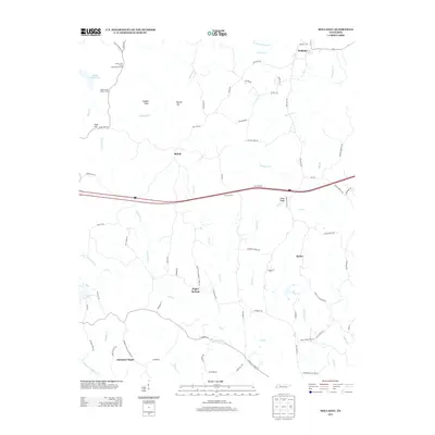
2013 Map of Holladay
USGS Topo · Published 2013About this map
The settlement of Holladay sits near the northern boundary of this West Tennessee landscape, where the headwaters of Birdsong Creek and Sycamore Creek begin their descent. This 2013 survey illustrates a rural community anchored by historical crossroads and small rural outposts like Shiloh, Poplar Springs, and Christian Chapel. The drainage patterns are a defining characteristic of the area, with the waters of Cane Creek and Willow Creek moving south toward the larger Cub Creek system.
Find a feature on this map
84 named features on this map. Tap any name to fly to it.
Don’t see what you’re looking for? This feature index may not catch every label — zoom into the map to look around manually.
Map Details
Editions of this 2013 Holladay Map
This is the sole edition of this map. No revisions or reprints were ever made.
Other maps of this area

1936 · Yuma
USGS Topo · 1:24,000

1936 · Parsons
USGS Topo · 1:24,000

1936 · Seventeen Creek
USGS Topo · 1:24,000

1936 · Jeannette
USGS Topo · 1:24,000

1936 · Sugar Tree
USGS Topo · 1:24,000

1936 · Cavvia
USGS Topo · 1:24,000

1936 · Buena Vista
USGS Topo · 1:24,000

1936 · Rockport
USGS Topo · 1:24,000

1936 · Chesterfield
USGS Topo · 1:24,000
1949 · Jeannette
USGS Topo · 1:24,000