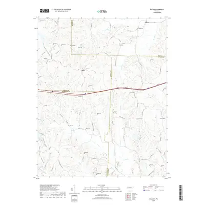
2019 Map of Holladay
USGS Topo · Published 2019About this map
The community of Holladay and the crossroads at Shiloh anchor this detailed 2019 survey of the West Tennessee landscape. Located where Carroll, Benton, Decatur, and Henderson Counties meet, the terrain is defined by a dense network of creek drainages including Birdsong Cr, Cub Cr, and Cane Cr. These waterways carve through the ridges, most notably Inman Ridge and Conrad Ridge, creating a complex topography that historically influenced local settlement patterns and the placement of the area's numerous family and community burial grounds.
Find a feature on this map
98 named features on this map. Tap any name to fly to it.
Don’t see what you’re looking for? This feature index may not catch every label — zoom into the map to look around manually.
Map Details
Editions of this 2019 Holladay Map
This is the sole edition of this map. No revisions or reprints were ever made.
Other maps of this area

1936 · Yuma
USGS Topo · 1:24,000

1936 · Parsons
USGS Topo · 1:24,000

1936 · Seventeen Creek
USGS Topo · 1:24,000

1936 · Jeannette
USGS Topo · 1:24,000

1936 · Sugar Tree
USGS Topo · 1:24,000

1936 · Cavvia
USGS Topo · 1:24,000

1936 · Buena Vista
USGS Topo · 1:24,000

1936 · Rockport
USGS Topo · 1:24,000

1936 · Chesterfield
USGS Topo · 1:24,000
1949 · Jeannette
USGS Topo · 1:24,000