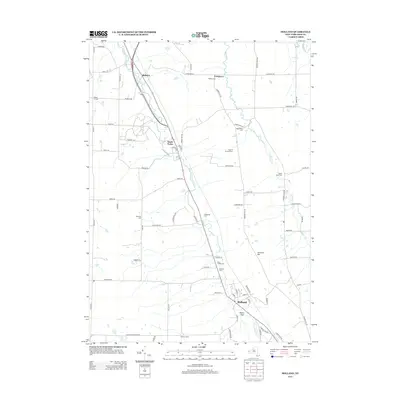
2013 Map of Holland
USGS Topo · Published 2013About this map
The East Br Cazenovia Cr and Hunter Cr carve a landscape defined by small Erie County hamlets and family-named landmarks. The village of Holland serves as a primary hub in the south, while South Wales and Blakeley sit along the western corridors. This 2013 survey provides a detailed view of the rural fabric, where long-established burial grounds like Goodleberg Cem and Saint Joseph Cem anchor the community history. The road network, including Vermont Hill Rd and Hunters Creek Rd, connects working landscapes such as Field Of Dreams Farm and Kramer Farms. Higher elevations like Vermont Hill and the descent into Gears Gulf reveal the varied terrain of the Cazenovia Creek watershed, offering genealogists and local historians a precise look at the township’s modern footprint.
Find a feature on this map
72 named features on this map. Tap any name to fly to it.
Don’t see what you’re looking for? This feature index may not catch every label — zoom into the map to look around manually.
Map Details
Editions of this 2013 Holland Map
This is the sole edition of this map. No revisions or reprints were ever made.
Other maps of this area

1905 · Attica
USGS Topo · 1:62,500

1905 · Depew
USGS Topo · 1:62,500

1923 · Arcade
USGS Topo · 1:62,500

1925 · Springville
USGS Topo · 1:62,500

1925 · Arcade
USGS Topo · 1:62,500

1948 · Depew
USGS Topo · 1:62,500

1949 · Attica
USGS Topo · 1:62,500

1949 · Cowlesville
USGS Topo · 1:24,000
1950 · Orchard Park
USGS Topo · 1:24,000
1950 · East Aurora
USGS Topo · 1:24,000