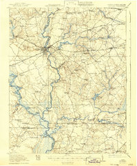
1920 Map of Holland
USGS Topo · Published 1942About this map
The Blackwater River and Somerton Creek define this rural borderland surveyed just after the Great War, where the river-and-rail economy of southern Virginia meets North Carolina. The hub of Franklin sits at a critical junction of the Southern Ry and Seaboard Air Line railroads, serving as a gateway for the region's timber and agricultural trade. This map documents a landscape of scattered family-named crossroads and centers of worship, such as Maynards Crossroads and Joyners Church. Water power and river access are paramount, evidenced by Holland Millpond and several specialized river landings like Milk Landing and Cox Landing. These features, along with Manning Ferry crossing the Chowan River, reveal a time when travel was still intimately tied to the waterways and local ferries before modern infrastructure reshaped the tidewater region.
Find a feature on this map
93 named features on this map. Tap any name to fly to it.
Don’t see what you’re looking for? This feature index may not catch every label — zoom into the map to look around manually.
Map Details
Editions of this 1920 Holland Map
2 editions found
Other maps of this area

1906 · Beckford
USGS Topo · 1:48,000

1907 · Beckford
USGS Topo · 1:62,500

1908 · Winton
USGS Topo · 1:62,500

1919 · Smithfield
USGS Topo · 1:62,500

1919 · Suffolk
USGS Topo · 1:62,500

1919 · Homeville
USGS Topo · 1:48,000

1919 · Boykins
USGS Topo · 1:48,000

1920 · Holland
USGS Topo · 1:62,500

1920 · Ivor
USGS Topo · 1:62,500

1920 · Homeville
USGS Topo · 1:62,500