
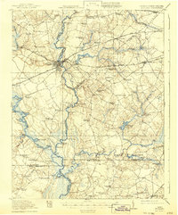
1920 Map of Holland
USGS Topo · Published 1920About this map
The Blackwater River and Nottoway River dominate this landscape during the late 1910s, serving as vital corridors for the timber and agricultural trade along the Virginia and North Carolina border. The bustling town of Franklin stands as a rail hub where the Southern and Seaboard Air Line railroads converge, facilitating the movement of goods from the surrounding swamplands. Numerous landings such as Milk Landing, Cox Landing, and Cathole Landing dot the riverbanks, marking the points where the river-based economy met the shore.
Find a feature on this map
94 named features on this map. Tap any name to fly to it.
Don’t see what you’re looking for? This feature index may not catch every label — zoom into the map to look around manually.
Map Details
Editions of this 1920 Holland Map
2 editions found
Other maps of this area

1906 · Beckford
USGS Topo · 1:48,000

1907 · Beckford
USGS Topo · 1:62,500

1908 · Winton
USGS Topo · 1:62,500

1919 · Smithfield
USGS Topo · 1:62,500

1919 · Suffolk
USGS Topo · 1:62,500

1919 · Homeville
USGS Topo · 1:48,000

1919 · Boykins
USGS Topo · 1:48,000

1920 · Ivor
USGS Topo · 1:62,500

1920 · Homeville
USGS Topo · 1:62,500

1920 · Boykins
USGS Topo · 1:62,500