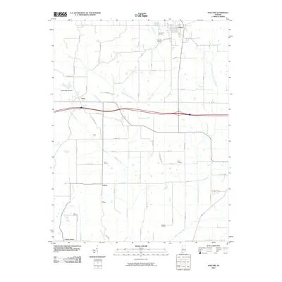
2010 Map of Holland
USGS Topo · Published 2010About this map
Holland anchors the northern reaches of this Indiana landscape, where a dense network of country roads connects scattered rural settlements. Moving south, the terrain is shaped by the winding courses of Sugar Creek and Pokeberry Creek, which flow toward the North Fork Little Pigeon Creek. This 2010 survey highlights a deeply established community structure, evident in the numerous burial grounds such as Saint James Cemetery and Augustana Cemetery near the main townsite. The western edge features Selvin, while smaller points like Heilman and Loafers Station mark significant crossroads for local genealogists and historians. The presence of Indian Fort and the Yellow Bank Lake Dam provides a look into the diverse land use of the area, ranging from early earthworks to modern water management infrastructure like Wires Ditch and Hutchinson Ditch.
Find a feature on this map
66 named features on this map. Tap any name to fly to it.
Don’t see what you’re looking for? This feature index may not catch every label — zoom into the map to look around manually.
Map Details
Editions of this 2010 Holland Map
This is the sole edition of this map. No revisions or reprints were ever made.
Other maps of this area

1900 · St Meinrad
USGS Topo · 1:62,500

1900 · De Gonia Springs
USGS Topo · 1:62,500

1902 · Ditney
USGS Topo · 1:125,000

1902 · Degonia Springs
USGS Topo · 1:62,500

1903 · St. Meinrad
USGS Topo · 1:62,500

1903 · Velpen
USGS Topo · 1:62,500

1954 · Huntingburg
USGS Topo · 1:24,000

1956 · Vincennes
USGS Topo · 1:250,000

1957 · Vincennes
USGS Topo · 1:250,000

1958 · Vincennes
USGS Topo · 1:250,000