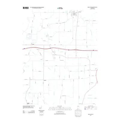
2013 Map of Holland
USGS Topo · Published 2013About this map
Holland anchors the northern portion of this southern Indiana landscape, showing a grid of streets including W Main St, E Kentucky Ave, and Jefferson St near Holland Lake. Moving south into the rural interior of Warrick and Spencer Counties, the terrain is defined by a dense network of waterways like Pokeberry Cr, Robinson Cr, and the N Fork Little Pigeon Cr. Smaller settlements and localized place names such as Selvin, Indian Fort, and Heilman provide valuable reference points for those tracing local family roots or historical land use patterns.
Find a feature on this map
104 named features on this map. Tap any name to fly to it.
Don’t see what you’re looking for? This feature index may not catch every label — zoom into the map to look around manually.
Map Details
Editions of this 2013 Holland Map
This is the sole edition of this map. No revisions or reprints were ever made.
Other maps of this area

1900 · St Meinrad
USGS Topo · 1:62,500

1900 · De Gonia Springs
USGS Topo · 1:62,500

1902 · Ditney
USGS Topo · 1:125,000

1902 · Degonia Springs
USGS Topo · 1:62,500

1903 · St. Meinrad
USGS Topo · 1:62,500

1903 · Velpen
USGS Topo · 1:62,500

1954 · Huntingburg
USGS Topo · 1:24,000

1956 · Vincennes
USGS Topo · 1:250,000

1957 · Vincennes
USGS Topo · 1:250,000

1958 · Vincennes
USGS Topo · 1:250,000