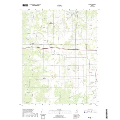
2019 Map of Holland
USGS Topo · Published 2019About this map
The town of Holland anchors the northern portion of this landscape, where the borders of Pike, Dubois, Warrick, and Spencer counties converge. This 2019 survey reflects a rural corridor defined by established agricultural plots and small settlements like Selvin, Heilman, and the curiously named Loafers Station. For genealogists, the map is particularly useful for its identification of numerous local burial sites, including Saint James Cem and Augustana Cem near Holland, as well as more isolated family grounds such as Avery Cem, Bruce Cem, and Twin Cem. The terrain is drained by Little Pigeon Cr in the south, while Holland Lake serves as a primary water feature near the main townsite. The road network remains largely rural, dominated by routes like Vincennes Rd and the Yellowbanks Trl, illustrating the persistent 19th-century settlement patterns in southwestern Indiana.
Find a feature on this map
80 named features on this map. Tap any name to fly to it.
Don’t see what you’re looking for? This feature index may not catch every label — zoom into the map to look around manually.
Map Details
Editions of this 2019 Holland Map
This is the sole edition of this map. No revisions or reprints were ever made.
Other maps of this area

1900 · St Meinrad
USGS Topo · 1:62,500

1900 · De Gonia Springs
USGS Topo · 1:62,500

1902 · Ditney
USGS Topo · 1:125,000

1902 · Degonia Springs
USGS Topo · 1:62,500

1903 · St. Meinrad
USGS Topo · 1:62,500

1903 · Velpen
USGS Topo · 1:62,500

1954 · Huntingburg
USGS Topo · 1:24,000

1956 · Vincennes
USGS Topo · 1:250,000

1957 · Vincennes
USGS Topo · 1:250,000

1958 · Vincennes
USGS Topo · 1:250,000