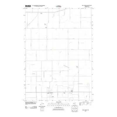
2010 Map of Hollandale
USGS Topo · Published 2010About this map
The agricultural landscape around Hollandale is defined by an extensive drainage network, where the natural flows of Mud Creek and Turtle Creek are supplemented by numbered engineering projects like Judicial Ditch Number Twelve and Judicial Ditch Number Twentyseven. These systems supported the intensive farming typical of Freeborn County during the early 21st century. The settlement of Hollandale serves as the local hub, featuring the Hollandale Post Office and nearby Ward Airport. Scattered throughout the township are numerous small burial sites that offer clues for family historians, ranging from the Clark Family Cemetery to larger denominational sites like Saint Ansgars Cemetery and Saint Marys Cemetery. To the east, the small community of Maple Island sits near where Deer Creek enters the drainage system, illustrating the region's transition from wetlands to productive cropland.
Find a feature on this map
45 named features on this map. Tap any name to fly to it.
Don’t see what you’re looking for? This feature index may not catch every label — zoom into the map to look around manually.
Map Details
Editions of this 2010 Hollandale Map
This is the sole edition of this map. No revisions or reprints were ever made.
Other maps of this area

1954 · Albert Lea
USGS Topo · 1:62,500

1954 · Hayward
USGS Topo · 1:62,500

1954 · Mason City
USGS Topo · 1:250,000

1957 · Mason City
USGS Topo · 1:250,000

1958 · Mason City
USGS Topo · 1:250,000

1967 · Steele Center
USGS Topo · 1:24,000

1967 · Bixby
USGS Topo · 1:24,000

1967 · Blooming Prairie
USGS Topo · 1:24,000

1967 · Hollandale
USGS Topo · 1:24,000
1967 · Hope
USGS Topo · 1:24,000