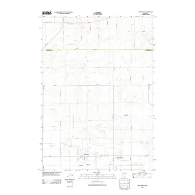
2013 Map of Hollandale
USGS Topo · Published 2013About this map
Hollandale anchors this agricultural landscape in southern Minnesota, situated near the intersection of MN-251 and Hague Ave. The terrain is defined by a dense network of water management features, including Judicial Ditch Number Twenty-eight, Judicial Ditch Number Twenty-seven, and Judicial Ditch Number Thirty, which reflect the historic drainage of the area's peatlands for cultivation. Genealogical interest is high on this sheet, which preserves the locations of several burial grounds such as Saint Marys Cem, Summit Cem, and the Clark Family Cem. To the east, the small settlement of Maple Island sits near the headwaters of Deer Cr, while Mud Cr and Knotvold Br wind through the surrounding fields, marking the natural hydrology that persistent ditching has sought to control.
Find a feature on this map
44 named features on this map. Tap any name to fly to it.
Don’t see what you’re looking for? This feature index may not catch every label — zoom into the map to look around manually.
Map Details
Editions of this 2013 Hollandale Map
This is the sole edition of this map. No revisions or reprints were ever made.
Other maps of this area

1954 · Albert Lea
USGS Topo · 1:62,500

1954 · Hayward
USGS Topo · 1:62,500

1954 · Mason City
USGS Topo · 1:250,000

1957 · Mason City
USGS Topo · 1:250,000

1958 · Mason City
USGS Topo · 1:250,000

1967 · Steele Center
USGS Topo · 1:24,000

1967 · Bixby
USGS Topo · 1:24,000

1967 · Blooming Prairie
USGS Topo · 1:24,000

1967 · Hollandale
USGS Topo · 1:24,000
1967 · Hope
USGS Topo · 1:24,000