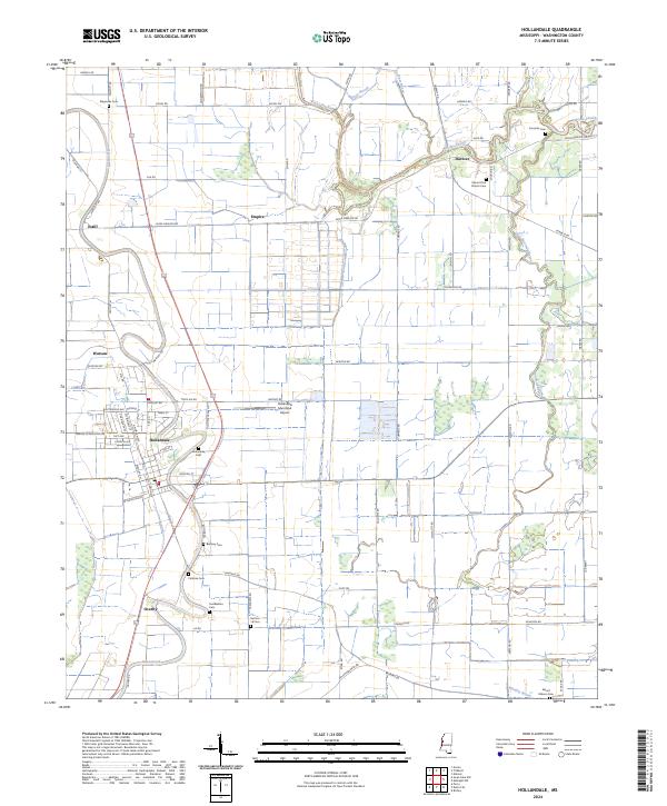
2024 Map of Hollandale
USGS Topo · Published 2024About this map
Hollandale serves as the primary hub in this portion of the Mississippi Delta, where a grid of rural roads and drainage canals defines the agricultural landscape. The township is surrounded by a network of smaller communities including Darlove, Empire, and Estill, each situated along traditional transport corridors like Old Hwy 61. Significant acreage is dedicated to the Holt Collier National Wildlife Refuge, which preserves segments of the bottomland environment once characteristic of the region.
Find a feature on this map
78 named features on this map. Tap any name to fly to it.
Don’t see what you’re looking for? This feature index may not catch every label — zoom into the map to look around manually.
Map Details
Editions of this 2024 Hollandale Map
This is the sole edition of this map. No revisions or reprints were ever made.
Other maps of this area

1939 · Tralake
USGS Topo · 1:62,500

1939 · Swan Lake
USGS Topo · 1:62,500

1940 · Auter
USGS Topo · 1:62,500

1940 · Baird
USGS Topo · 1:62,500

1953 · Greenwood
USGS Topo · 1:250,000

1956 · Greenwood
USGS Topo · 1:250,000
1965 · Richey
USGS Topo · 1:24,000

1965 · Kinlock
USGS Topo · 1:24,000
1965 · Midnight NW
USGS Topo · 1:24,000

1967 · Baird
USGS Topo · 1:62,500