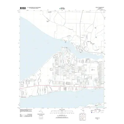
2012 Map of Holley
USGS Topo · Published 2012About this map
Holley and Woodlawn Beach anchor this coastal landscape along the north shore of the Santa Rosa Sound. The terrain transitions from the low-lying waters of East Bay to the inland military tracts of Eglin Air Force Base. The map reveals a high concentration of specialized aviation infrastructure, notably the Choctaw Naval Outlying Field in the north and the Holley Naval Outlying Field to the east.
Find a feature on this map
237 named features on this map. Tap any name to fly to it.
Don’t see what you’re looking for? This feature index may not catch every label — zoom into the map to look around manually.
Map Details
Editions of this 2012 Holley Map
This is the sole edition of this map. No revisions or reprints were ever made.
Other maps of this area

1920 · Milton
USGS Topo · 1:62,500

1921 · Holley
USGS Topo · 1:62,500

1921 · Pensacola
USGS Topo · 1:62,500

1934 · Harold
USGS Topo · 1:62,500

1936 · Holley
USGS Topo · 1:48,000

1937 · Harold
USGS Topo · 1:62,500

1938 · Holley
USGS Topo · 1:62,500

1938 · Harold
USGS Topo · 1:62,500

1941 · Pensacola
USGS Topo · 1:62,500

1941 · Milton
USGS Topo · 1:62,500