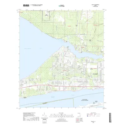
2018 Map of Holley
USGS Topo · Published 2018About this map
Navarre and its coastal surroundings are defined by the dense residential grids that bridge the mainland and Santa Rosa Island. This 2018 survey documents the intricate street network of Woodlawn Beach and the expanding development south of Eglin Air Force Base. The coastal landscape is shaped by military infrastructure, including Choctaw Naval Outlying Field (NOLF Choctaw) and NOLF Holley, which coexist with protected natural reaches like the Gulf Islands National Seashore.
Find a feature on this map
236 named features on this map. Tap any name to fly to it.
Don’t see what you’re looking for? This feature index may not catch every label — zoom into the map to look around manually.
Map Details
Editions of this 2018 Holley Map
This is the sole edition of this map. No revisions or reprints were ever made.
Other maps of this area

1920 · Milton
USGS Topo · 1:62,500

1921 · Holley
USGS Topo · 1:62,500

1921 · Pensacola
USGS Topo · 1:62,500

1934 · Harold
USGS Topo · 1:62,500

1936 · Holley
USGS Topo · 1:48,000

1937 · Harold
USGS Topo · 1:62,500

1938 · Holley
USGS Topo · 1:62,500

1938 · Harold
USGS Topo · 1:62,500

1941 · Pensacola
USGS Topo · 1:62,500

1941 · Milton
USGS Topo · 1:62,500