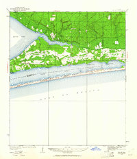
1936 Map of Holley
USGS Topo · Published 1961About this map
Santa Rosa Island National Monument dominates the southern reaches of this 1930s survey, separating the Gulf of Mexico from the protected waters of the Santa Rosa Sound. The landscape is characterized by a transition from the narrow barrier island to the mainland forest and swamp systems. Along the northern shores of East Bay, small settlements like Holley serve as focal points for the coastal community, situated near the East Bay Ranger Sta and the East Bay Ch.
Find a feature on this map
30 named features on this map. Tap any name to fly to it.
Don’t see what you’re looking for? This feature index may not catch every label — zoom into the map to look around manually.
Map Details
Editions of this 1936 Holley Map
3 editions found
Other maps of this area

1920 · Milton
USGS Topo · 1:62,500

1921 · Holley
USGS Topo · 1:62,500

1921 · Pensacola
USGS Topo · 1:62,500

1934 · Holt
USGS Topo · 1:48,000

1934 · Harold
USGS Topo · 1:62,500

1936 · Holley
USGS Topo · 1:48,000

1937 · Holt
USGS Topo · 1:62,500

1937 · Harold
USGS Topo · 1:62,500

1938 · Mary Esther
USGS Topo · 1:62,500

1938 · Holley
USGS Topo · 1:62,500