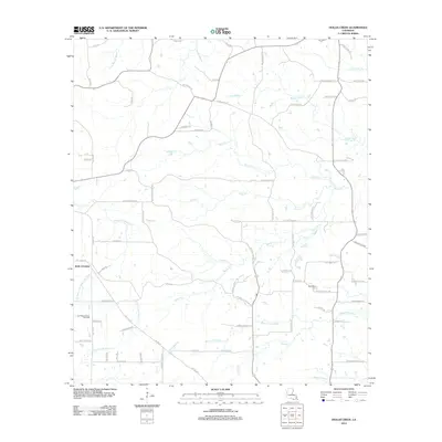
2012 Map of Hollis Creek
USGS Topo · Published 2012About this map
Bayou San Miguel and its many tributaries, including Rocks Cr and Stacy Cr, define this part of the Louisiana landscape. The area is marked by the presence of the San Miguel Creek Oil Field in the west, indicating the region's long-standing connection to resource extraction. Settlement is dispersed, with Dobs Crossing serving as a primary point of reference amidst a network of local roads such as Blue Ridge Church Rd and McCaskill Cemetery Rd. The terrain is characterized by complex hydrography, where Bayou Terre Blanc and Gum Bayou drain the eastern lowlands. Genealogists may find interest in McCartney Cem, which sits near the southern bend of Rocks Cr, reflecting the rural burial patterns of the local community during this era of Sabine Parish history.
Find a feature on this map
84 named features on this map. Tap any name to fly to it.
Don’t see what you’re looking for? This feature index may not catch every label — zoom into the map to look around manually.
Map Details
Editions of this 2012 Hollis Creek Map
This is the sole edition of this map. No revisions or reprints were ever made.
Other maps of this area

1938 · Chemard Lake
USGS Topo · 1:31,680

1938 · Hollis Creek
USGS Topo · 1:31,680

1938 · Allen
USGS Topo · 1:31,680

1938 · Lake End
USGS Topo · 1:31,680

1941 · Zwolle
USGS Topo · 1:62,500

1941 · Pelican
USGS Topo · 1:62,500

1942 · Many
USGS Topo · 1:62,500

1943 · Many
USGS Topo · 1:62,500

1943 · Pleasant Hill
USGS Topo · 1:62,500

1944 · Zwolle
USGS Topo · 1:62,500