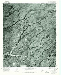
1976 Map of Holloman NE
USGS Topo · Published 1980About this map
Mc Natt Ranch sits as the central point of interest in this 1976 orthophotoquad of Otero County, New Mexico. The landscape is defined by a network of drainage features that cut through the arid terrain, including the prominent Hay Draw and the serpentine path of Malone Draw. This photographic survey, produced by the Geological Survey in cooperation with the Soil Conservation Service, captures the exact state of the land surface before later decades of change. To the northeast, the distinct course of Arroyo Lavacita is visible, while Red Draw marks the southeastern portion of the quadrangle. The imagery provides an unvarnished look at the distribution of vegetation and the sparse human footprint in this part of the Chihuahuan Desert during the mid-1970s.
Find a feature on this map
5 named features on this map. Tap any name to fly to it.
Don’t see what you’re looking for? This feature index may not catch every label — zoom into the map to look around manually.
Map Details
Editions of this 1976 Holloman NE Map
This is the sole edition of this map. No revisions or reprints were ever made.
Other maps of this area

1916 · Tularosa
USGS Topo · 1:125,000

1916 · Point Of Sands
USGS Topo · 1:125,000

1948 · Tularosa
USGS Topo · 1:62,500

1948 · Holloman
USGS Topo · 1:62,500

1950 · Alamogordo
USGS Topo · 1:62,500

1950 · Mescalero
USGS Topo · 1:62,500

1954 · Carlsbad
USGS Topo · 1:250,000

1954 · Tularosa
USGS Topo · 1:250,000

1955 · Las Cruces
USGS Topo · 1:250,000

1955 · Roswell
USGS Topo · 1:250,000