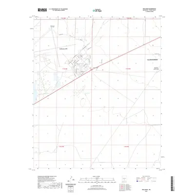
2020 Map of Holloman
USGS Topo · Published 2020About this map
Holloman Air Force Base dominates this Tularosa Basin landscape, showing the intensive infrastructure of the military installation as it appeared in the late 2010s. The residential and administrative core of Holloman AFB is mapped in detail, featuring a network of streets such as W Connecticut Ave, W New Mexico Ave, and Alamo Cir. To the east, the western fringes of Alamogordo and the Alamogordo-White Sands Regional Airport mark the transition toward the Sacramento Mountains. The surrounding high-desert terrain is defined by natural drainage features like Dillard Draw and the isolated Mogee Tank, illustrating the hydrological management necessary in this arid environment. The map captures the interface between federal defense lands and municipal growth during a period of continued regional development.
Find a feature on this map
38 named features on this map. Tap any name to fly to it.
Don’t see what you’re looking for? This feature index may not catch every label — zoom into the map to look around manually.
Map Details
Editions of this 2020 Holloman Map
This is the sole edition of this map. No revisions or reprints were ever made.
Other maps of this area

1916 · Point Of Sands
USGS Topo · 1:125,000

1948 · Tres Hermanos
USGS Topo · 1:62,500

1948 · Holloman
USGS Topo · 1:62,500

1950 · Escondido Canyon
USGS Topo · 1:62,500

1950 · Alamogordo
USGS Topo · 1:62,500

1954 · Carlsbad
USGS Topo · 1:250,000

1955 · Las Cruces
USGS Topo · 1:250,000

1958 · Las Cruces
USGS Topo · 1:250,000

1958 · Carlsbad
USGS Topo · 1:250,000

1976 · Mule Peak
USGS Topo · 1:24,000