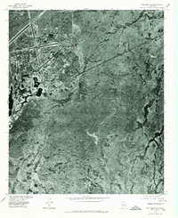
1976 Map of Holloman SE
USGS Topo · Published 1980About this map
Holloman Air Force Base dominates the northwest quadrant of this orthophotoquad, revealing the complex infrastructure of runways, hangars, and residential housing blocks as they existed in the mid-1970s. This hybrid map uses rectified aerial photography from March 1976 to show the desert floor in stark detail, contrasting the high-density military installation against the vast, arid terrain of the Tularosa Basin. Beyond the geometric precision of the base, the landscape is defined by natural drainage patterns and sparse vegetation typical of the region's Chihuahuan Desert environment. The photograph captures the installation's physical footprint just as it was becoming a primary site for tactical fighter training, providing a clear visual record of the specialized water management structures and transportation corridors that supported the military community in Otero County.
Find a feature on this map
1 named feature on this map. Tap any name to fly to it.
Don’t see what you’re looking for? This feature index may not catch every label — zoom into the map to look around manually.
Map Details
Editions of this 1976 Holloman SE Map
This is the sole edition of this map. No revisions or reprints were ever made.
Other maps of this area

1916 · Point Of Sands
USGS Topo · 1:125,000

1948 · Tres Hermanos
USGS Topo · 1:62,500

1948 · Holloman
USGS Topo · 1:62,500

1950 · Escondido Canyon
USGS Topo · 1:62,500

1950 · Alamogordo
USGS Topo · 1:62,500

1954 · Carlsbad
USGS Topo · 1:250,000

1955 · Las Cruces
USGS Topo · 1:250,000

1958 · Las Cruces
USGS Topo · 1:250,000

1958 · Carlsbad
USGS Topo · 1:250,000

1976 · Mule Peak
USGS Topo · 1:24,000