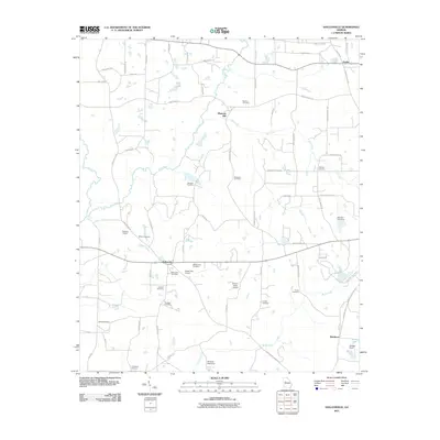
2011 Map of Hollonville
USGS Topo · Published 2011About this map
Hollonville and Zetella anchor this rural landscape in Pike County, where the topography is defined by the winding course of the Flint River. The map reveals a high density of burial grounds, providing a significant resource for genealogical research with sites such as Hollonville Cemetery, Shoal Creek Cemetery, and Bethany Cemetery scattered across the countryside. The presence of several small airfields, including Powers Airport and the Shade Tree Airport, suggests a local aviation culture tucked between the agricultural fields and woodlots.
Find a feature on this map
73 named features on this map. Tap any name to fly to it.
Don’t see what you’re looking for? This feature index may not catch every label — zoom into the map to look around manually.
Map Details
Editions of this 2011 Hollonville Map
This is the sole edition of this map. No revisions or reprints were ever made.
Other maps of this area

1953 · Atlanta
USGS Topo · 1:250,000

1957 · Atlanta
USGS Topo · 1:250,000

1958 · Atlanta
USGS Topo · 1:250,000

1965 · Senoia
USGS Topo · 1:24,000

1965 · Griffin North
USGS Topo · 1:24,000

1965 · Brooks
USGS Topo · 1:24,000

1971 · Hollonville
USGS Topo · 1:24,000
1971 · Haralson
USGS Topo · 1:24,000
1971 · Gay
USGS Topo · 1:24,000
1971 · Griffin South
USGS Topo · 1:24,000