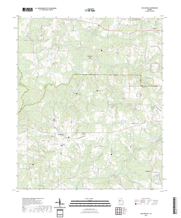
2024 Map of Hollonville
USGS Topo · Published 2024About this map
Blantons Mill and the surrounding agricultural landscape define this portion of the Georgia Piedmont, where the Flint River carves a path through the tri-county border of Spalding, Pike, and Meriwether counties. The settlement patterns are characterized by small community clusters like Hollonville and Zetella, interconnected by a dense network of country roads such as Newnan Rd and Hollonville Rd. The map reveals a high concentration of localized family and community landmarks, particularly through its numerous cemeteries including Ackiss Cem, Wilson Cem, and Driver Cem.
Find a feature on this map
107 named features on this map. Tap any name to fly to it.
Don’t see what you’re looking for? This feature index may not catch every label — zoom into the map to look around manually.
Map Details
Editions of this 2024 Hollonville Map
This is the sole edition of this map. No revisions or reprints were ever made.
Other maps of this area

1953 · Atlanta
USGS Topo · 1:250,000

1957 · Atlanta
USGS Topo · 1:250,000

1958 · Atlanta
USGS Topo · 1:250,000

1965 · Senoia
USGS Topo · 1:24,000

1965 · Griffin North
USGS Topo · 1:24,000

1965 · Brooks
USGS Topo · 1:24,000

1971 · Hollonville
USGS Topo · 1:24,000
1971 · Haralson
USGS Topo · 1:24,000
1971 · Gay
USGS Topo · 1:24,000
1971 · Griffin South
USGS Topo · 1:24,000