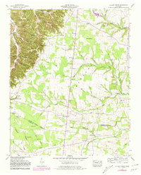
1953 Map of Hollow Springs
USGS Topo · Published 1981About this map
Rains Ridge and Sinkhole Ridge define the northern landscape of this region, where the terrain is punctuated by significant karst features like Jimmison Cave and King Cave. This 1953 survey, later updated in 1981, captures a rural Tennessee environment where small communities like Hollow Springs and Pocahontas are connected by winding roads and a dense network of family cemeteries. The mapping reveals a local reliance on water sources such as Cisco Spring and Wildwood Lake, while the Tennessee Valley Divide runs through the southern section, marking a major geographical boundary between Cannon and Coffee counties. Local social centers are well-documented, including Simmons Chapel and the Greedville Sch, alongside unique landmarks like the Lookout Tower on Cove Hill, reflecting a mid-century settlement pattern focused on ridge-and-valley agriculture.
Find a feature on this map
64 named features on this map. Tap any name to fly to it.
Don’t see what you’re looking for? This feature index may not catch every label — zoom into the map to look around manually.
Map Details
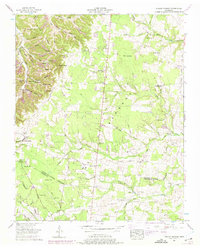
Editions of this 1953 Hollow Springs Map
2 editions found
Other maps of this area

1893 · Mc Minnville
USGS Topo · 1:125,000

1895 · Mc Minnville
USGS Topo · 1:125,000

1908 · Woodbury
USGS Topo · 1:62,500

1913 · Hollow Springs
USGS Topo · 1:62,500

1936 · Fredonia
USGS Topo · 1:24,000

1936 · Beech Grove
USGS Topo · 1:24,000

1936 · Petty Gap
USGS Topo · 1:24,000

1936 · Noah
USGS Topo · 1:24,000

1936 · Morrison
USGS Topo · 1:24,000

1942 · Statesville
USGS Topo · 1:100,000