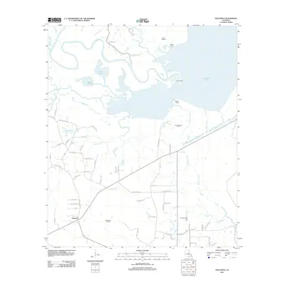
2012 Map of Holloway
USGS Topo · Published 2012About this map
The low-lying wetlands of Rapides Parish are defined by the expansive waters of Catahoula Lake and a complex network of bayous and prairies. In this 2012 landscape, the settlement of Holloway sits near the southern edge of the Holloway Prairie, while to the north, the Little River meanders through a labyrinth of named terrain including Catfish Prairie and Middle Prairie. This environment reflects the transition from the river bottomlands to the managed extraction areas of the South Catahoula Oil Field and North Big Island Oil Field. Many local roads bear the names of families rooted in the region, such as Corley Loop, ER Slay Rd, and Arthur O'Neal Rd. The hydrography is particularly detailed, showing the convergence of Duck Slough, Big Saline Bayou, and Slash Bayou as they navigate the flat, periodically inundated terrain typical of central Louisiana's river basins.
Find a feature on this map
72 named features on this map. Tap any name to fly to it.
Don’t see what you’re looking for? This feature index may not catch every label — zoom into the map to look around manually.
Map Details
Editions of this 2012 Holloway Map
This is the sole edition of this map. No revisions or reprints were ever made.
Other maps of this area

1936 · Pollock
USGS Topo · 1:62,500

1941 · Jena
USGS Topo · 1:62,500

1941 · Alexandria
USGS Topo · 1:62,500

1941 · Buckeye
USGS Topo · 1:62,500

1941 · Pollock
USGS Topo · 1:62,500

1953 · Alexandria
USGS Topo · 1:250,000

1955 · Alexandria
USGS Topo · 1:250,000

1957 · Alexandria
USGS Topo · 1:62,500

1958 · Pollock
USGS Topo · 1:62,500

1958 · Jena
USGS Topo · 1:62,500