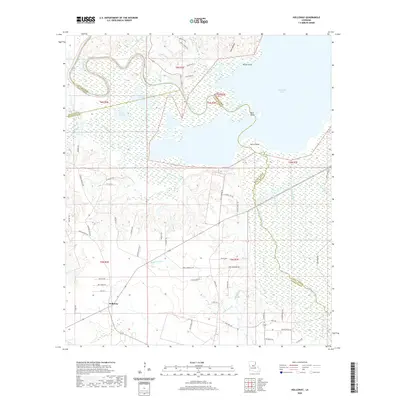
2020 Map of Holloway
USGS Topo · Published 2020About this map
The settlement of Holloway serves as the focal point for this landscape where Rapides Parish meets Lasalle Parish and Grant Parish. The geography is defined by the expansive Catahoula Lake to the east and the meandering Little River, which forms a complex boundary between the parishes. The low-lying terrain is characterized by seasonal water levels and distinct ecological zones, including Catfish Prairie and Middle Prairie.
Find a feature on this map
69 named features on this map. Tap any name to fly to it.
Don’t see what you’re looking for? This feature index may not catch every label — zoom into the map to look around manually.
Map Details
Editions of this 2020 Holloway Map
This is the sole edition of this map. No revisions or reprints were ever made.
Other maps of this area

1936 · Pollock
USGS Topo · 1:62,500

1941 · Jena
USGS Topo · 1:62,500

1941 · Alexandria
USGS Topo · 1:62,500

1941 · Buckeye
USGS Topo · 1:62,500

1941 · Pollock
USGS Topo · 1:62,500

1953 · Alexandria
USGS Topo · 1:250,000

1955 · Alexandria
USGS Topo · 1:250,000

1957 · Alexandria
USGS Topo · 1:62,500

1958 · Pollock
USGS Topo · 1:62,500

1958 · Jena
USGS Topo · 1:62,500