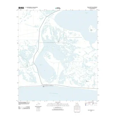
2012 Map of Holly Beach
USGS Topo · Published 2012About this map
Holly Beach sits at the edge of the Gulf of Mexico in this 2012 survey, anchored by a grid of coastal streets including Egret St and Teal St. The landscape is dominated by a complex network of brackish waterways and marshland, with Mud Lake and Oyster Lake serving as central landmarks. This area reflects a long-standing intersection of coastal recreation and industrial utility, as evidenced by the presence of the East Mud Lake Gas Field and East Holly Beach Gas Field. Navigation through this fluid geography relies on named passages like Mud Pass and the winding Oyster Bayou. To the north, the expanse of Calcasieu Lake and the isolated Rabbit Island define the upper reaches of the quadrangle, while the Mobil-Fina-Texaco Oil Field Rd provides essential terrestrial access across the wetlands to support local energy infrastructure.
Find a feature on this map
21 named features on this map. Tap any name to fly to it.
Don’t see what you’re looking for? This feature index may not catch every label — zoom into the map to look around manually.
Map Details
Editions of this 2012 Holly Beach Map
This is the sole edition of this map. No revisions or reprints were ever made.
Other maps of this area

1934 · Cameron
USGS Topo · 1:24,000

1934 · Holly Beach
USGS Topo · 1:24,000

1934 · Peveto Beach
USGS Topo · 1:24,000

1934 · Browns Lake
USGS Topo · 1:24,000

1934 · Five Lakes
USGS Topo · 1:24,000

1935 · Peveto Beach
USGS Topo · 1:31,680

1935 · Cameron
USGS Topo · 1:31,680

1935 · Five Lakes
USGS Topo · 1:31,680

1935 · Hackberry
USGS Topo · 1:31,680

1935 · Holly Beach
USGS Topo · 1:31,680