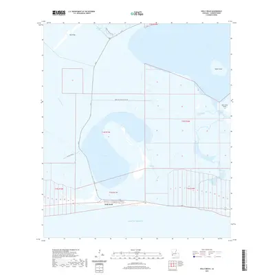
2020 Map of Holly Beach
USGS Topo · Published 2020About this map
Holly Beach sits at the southern edge of this Cameron Parish landscape, where the marshlands of Southwest Louisiana meet the Gulf of Mexico. The coastal community is defined by a tight grid of streets, including Teal St and Heron St, positioned between the open water and the expansive Mud Lake. This 2020 survey reveals the complex hydrology of the Chenier Plain, where natural features like First Bayou and Second Bayou navigate the low-lying terrain alongside industrial infrastructure such as the Fina Oil Field Rd and the Mobil-Fina-Texaco Oil Field Rd. Further inland, the Wetland Walkway Trail provides access to the marshes near the Back Ridge Canal. The eastern portion of the map is dominated by the waters of West Cove, punctuated by Rabbit Island and Saint Johns Island, showing the vital water passages of West Fork Calcasieu Pass and Oyster Bayou.
Find a feature on this map
29 named features on this map. Tap any name to fly to it.
Don’t see what you’re looking for? This feature index may not catch every label — zoom into the map to look around manually.
Map Details
Editions of this 2020 Holly Beach Map
This is the sole edition of this map. No revisions or reprints were ever made.
Other maps of this area

1934 · Cameron
USGS Topo · 1:24,000

1934 · Holly Beach
USGS Topo · 1:24,000

1934 · Peveto Beach
USGS Topo · 1:24,000

1934 · Browns Lake
USGS Topo · 1:24,000

1934 · Five Lakes
USGS Topo · 1:24,000

1935 · Peveto Beach
USGS Topo · 1:31,680

1935 · Cameron
USGS Topo · 1:31,680

1935 · Five Lakes
USGS Topo · 1:31,680

1935 · Hackberry
USGS Topo · 1:31,680

1935 · Holly Beach
USGS Topo · 1:31,680