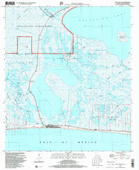
1998 Map of Holly Beach
USGS Topo · Published 2000About this map
Sabine National Wildlife Refuge dominates this coastal landscape, protecting a complex network of wetlands and waterways north of the Gulf of Mexico. The coastal settlement of Holly Beach serves as a focal point along the shoreline, accompanied by the small community of Hollynd. This 1990s survey illustrates a region defined by its precarious balance between natural conservation and industrial utility, where an extensive network of pipelines crisscrosses the marshes to support the East Holly Beach Gas Field and Mud Lake Gas Field. Access to the interior is provided by features such as the Refuge Boat Ramp and the Creole Nature Trail. Prominent water bodies like Calcasieu Lake and Mud Lake are central to the geography, while landforms such as Back Ridge and Rabbit Island rise slightly above the surrounding marsh and West Cove.
Find a feature on this map
31 named features on this map. Tap any name to fly to it.
Don’t see what you’re looking for? This feature index may not catch every label — zoom into the map to look around manually.
Map Details
Editions of this 1998 Holly Beach Map
This is the sole edition of this map. No revisions or reprints were ever made.
Other maps of this area

1934 · Cameron
USGS Topo · 1:24,000

1934 · Holly Beach
USGS Topo · 1:24,000

1934 · Peveto Beach
USGS Topo · 1:24,000

1934 · Browns Lake
USGS Topo · 1:24,000

1934 · Five Lakes
USGS Topo · 1:24,000

1935 · Peveto Beach
USGS Topo · 1:31,680

1935 · Cameron
USGS Topo · 1:31,680

1935 · Five Lakes
USGS Topo · 1:31,680

1935 · Hackberry
USGS Topo · 1:31,680

1935 · Holly Beach
USGS Topo · 1:31,680