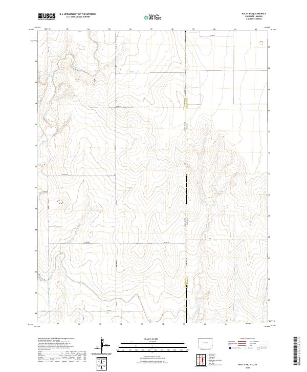
2022 Map of Holly NE
USGS Topo · Published 2022About this map
Amity Canal and its associated infrastructure define the agricultural landscape of this high-plains borderland where Colorado meets Kansas. The presence of the Hazel Lateral and Amity Canal Rd underscores the long-standing importance of water management in the arid West. This 2022 survey captures the drainage patterns across the Prowers and Hamilton county line, dominated by the intermittent flows of Wild Horse Creek and its tributaries like West Wild Horse Creek and E Horse Cr. The land is meticulously gridded by county roads such as Co RD 35 and Co RD NN, reflecting the enduring Public Land Survey System. The transition from the high ground of T21S R41W into the draws of Cheyenne Cr and Spring Cr provides a clear view of how topographical relief and water rights dictate the placement of rural infrastructure.
Find a feature on this map
29 named features on this map. Tap any name to fly to it.
Don’t see what you’re looking for? This feature index may not catch every label — zoom into the map to look around manually.
Map Details
Editions of this 2022 Holly NE Map
This is the sole edition of this map. No revisions or reprints were ever made.
Other maps of this area

1890 · Granada
USGS Topo · 1:125,000

1892 · Granada
USGS Topo · 1:125,000

1894 · Granada
USGS Topo · 1:125,000

1953 · Holly West
USGS Topo · 1:24,000

1953 · Holly East
USGS Topo · 1:24,000

1954 · Lamar
USGS Topo · 1:250,000

1955 · Holly NE
USGS Topo · 1:24,000
1955 · Holly NW
USGS Topo · 1:24,000

1955 · Scott City
USGS Topo · 1:250,000

1958 · Lamar
USGS Topo · 1:250,000