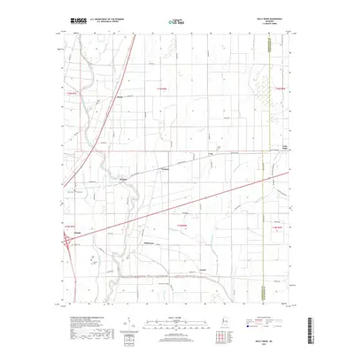
2018 Map of Holly Ridge
USGS Topo · Published 2018About this map
The agricultural landscape of the Mississippi Delta is defined by the winding course of Bogue Phalia and its numerous offshoots, including Deep Slough and Sixmile Bayou. This modern topographic survey of Sunflower and Washington counties reveals a pattern of small settlements and family burial grounds that persist amidst the extensive drainage networks of the region. Distinct communities like Holly Ridge, Dunleith, and Hollyknowe are connected by a grid of rural roads, such as Long Switch Rd and Tribbett Rd. The map is particularly useful for genealogical research, identifying numerous small cemeteries including Evening Star Cem, Hinds Cem, and Charity Cem. These landmarks, along with established towns like Leland, provide a clear picture of the contemporary human footprint on this historically significant floodplain.
Find a feature on this map
68 named features on this map. Tap any name to fly to it.
Don’t see what you’re looking for? This feature index may not catch every label — zoom into the map to look around manually.
Map Details
Editions of this 2018 Holly Ridge Map
This is the sole edition of this map. No revisions or reprints were ever made.
Other maps of this area

1934 · Cleveland
USGS Topo · 1:62,500

1939 · Tralake
USGS Topo · 1:62,500

1939 · Choctaw
USGS Topo · 1:62,500

1940 · Baird
USGS Topo · 1:62,500

1940 · Cleveland
USGS Topo · 1:62,500

1953 · Greenwood
USGS Topo · 1:250,000

1956 · Greenwood
USGS Topo · 1:250,000

1965 · Indianola
USGS Topo · 1:24,000

1965 · Kinlock
USGS Topo · 1:24,000

1967 · Baird
USGS Topo · 1:62,500