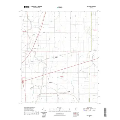
2020 Map of Holly Ridge
USGS Topo · Published 2020About this map
Bogue Phalia and its winding tributaries dominate this Mississippi Delta landscape at the border of Washington and Sunflower counties. The map documents a structured agricultural grid defined by an extensive network of drainage features like Deep Slough, Sixmile Bayou, and Johnson Bayou. Smaller communities and junctions including Rexburg, Dunleith, Geneill, and Hollyknowe are scattered across the quadrangle, connected by a dense web of local roads such as Taylor Rd and Tribbett Rd.
Find a feature on this map
68 named features on this map. Tap any name to fly to it.
Don’t see what you’re looking for? This feature index may not catch every label — zoom into the map to look around manually.
Map Details
Editions of this 2020 Holly Ridge Map
This is the sole edition of this map. No revisions or reprints were ever made.
Other maps of this area

1934 · Cleveland
USGS Topo · 1:62,500

1939 · Tralake
USGS Topo · 1:62,500

1939 · Choctaw
USGS Topo · 1:62,500

1940 · Baird
USGS Topo · 1:62,500

1940 · Cleveland
USGS Topo · 1:62,500

1953 · Greenwood
USGS Topo · 1:250,000

1956 · Greenwood
USGS Topo · 1:250,000

1965 · Indianola
USGS Topo · 1:24,000

1965 · Kinlock
USGS Topo · 1:24,000

1967 · Baird
USGS Topo · 1:62,500