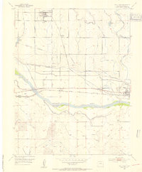
1953 Map of Holly West
USGS Topo · Published 1954About this map
The Atchison Topeka and Santa Fe railroad corridor anchors this agricultural landscape along the Arkansas River in southeastern Colorado. Water management is the central theme of the 1950s terrain, with an intricate network including the Amity Canal, Buffalo Canal, and Holly Ditch feeding the flats north of the river. The map marks the significant intersection of modern transit and pioneer history, tracing segments of the Santa Fe Trail and the Old Santa Fe Trail alongside more contemporary features like the Fair Grounds in Holly. Small settlements like Hartman, with its Water Tower and Grain Elevator, serve as local hubs for the surrounding farms. Researchers will find the Hartman Cemetery and Amity Cemetery clearly plotted, along with a Historical Marker near Amity, providing specific points of interest for genealogists and local historians.
Find a feature on this map
30 named features on this map. Tap any name to fly to it.
Don’t see what you’re looking for? This feature index may not catch every label — zoom into the map to look around manually.
Map Details
Editions of this 1953 Holly West Map
4 editions found
Other maps of this area

1890 · Granada
USGS Topo · 1:125,000

1891 · Albany
USGS Topo · 1:125,000

1892 · Granada
USGS Topo · 1:125,000

1893 · Albany
USGS Topo · 1:125,000

1894 · Granada
USGS Topo · 1:125,000

1953 · Holly West
USGS Topo · 1:24,000

1953 · Granada
USGS Topo · 1:24,000

1953 · Holly East
USGS Topo · 1:24,000

1954 · Lamar
USGS Topo · 1:250,000

1955 · Holly NE
USGS Topo · 1:24,000