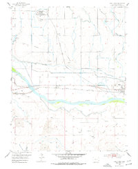
1953 Map of Holly West
USGS Topo · Published 1977About this map
The Arkansas River valley in Prowers County defines this mid-century landscape, where a complex network of irrigation infrastructure supports the high plains agriculture of eastern Colorado. This survey reveals the critical role of water management through features like the Amity Canal, Sisson Canal, and Buffalo Canal, which parallel the river's course. The historic Old Santa Fe Trail and a designated Wagon Road are visible, tracing the older paths of westward expansion alongside the modern Atchison Topeka and Santa Fe railroad line. Settlement patterns center on small communities like Hartman, Amity, and the western edge of Holly. Local landmarks such as the Hartman Cemetery, Amity Cemetery, and a Grain Elevator provide valuable points of reference for genealogists and researchers interested in the era's rural infrastructure and community layout.
Find a feature on this map
37 named features on this map. Tap any name to fly to it.
Don’t see what you’re looking for? This feature index may not catch every label — zoom into the map to look around manually.
Map Details
Editions of this 1953 Holly West Map
4 editions found
Other maps of this area

1890 · Granada
USGS Topo · 1:125,000

1891 · Albany
USGS Topo · 1:125,000

1892 · Granada
USGS Topo · 1:125,000

1893 · Albany
USGS Topo · 1:125,000

1894 · Granada
USGS Topo · 1:125,000

1953 · Holly West
USGS Topo · 1:24,000

1953 · Granada
USGS Topo · 1:24,000

1953 · Holly East
USGS Topo · 1:24,000

1954 · Lamar
USGS Topo · 1:250,000

1955 · Holly NE
USGS Topo · 1:24,000