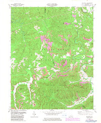
1979 Map of Hollyhill
USGS Topo · Published 1983About this map
Hollyhill serves as a focal point in this landscape where the boundaries of McCreary Co and Whitley Co meet. The terrain is defined by a dense network of drainages and hollows, including Marsh Creek and Jellico Creek, which cut through the southern reaches of the Daniel Boone National Forest. Local history is anchored by several rural landmarks, such as New Liberty Ch, Bethel Ch, and Laurel Cem, offering specific points of interest for genealogical research.
Find a feature on this map
46 named features on this map. Tap any name to fly to it.
Don’t see what you’re looking for? This feature index may not catch every label — zoom into the map to look around manually.
Map Details
Editions of this 1979 Hollyhill Map
2 editions found
Other maps of this area

1890 · Williamsburg
USGS Topo · 1:125,000

1894 · Williamsburg
USGS Topo · 1:125,000

1952 · Wofford
USGS Topo · 1:24,000

1952 · Hollyhill
USGS Topo · 1:24,000

1952 · Wiborg
USGS Topo · 1:24,000

1952 · Cumberland Falls
USGS Topo · 1:24,000

1952 · Williamsburg
USGS Topo · 1:24,000

1952 · Whitley City
USGS Topo · 1:24,000
1953 · Winfield
USGS Topo · 1:24,000
1953 · Jellico West
USGS Topo · 1:24,000