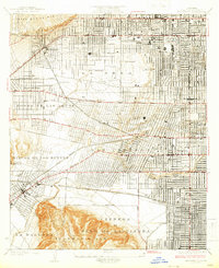
1926 Map of Hollywood
USGS Topo · Published 1926About this map
La Brea oil fields and the expanding street grid of mid-1920s Los Angeles define this survey, captured just as the region transitioned from a petroleum-rich landscape into an iconic residential and commercial hub. The Pacific Electric lines intersect the developing neighborhoods of Sherman and Vineyard, providing vital transit between the rising heights of Hollywood and the established boundaries of Beverly Hills.
Find a feature on this map
34 named features on this map. Tap any name to fly to it.
Don’t see what you’re looking for? This feature index may not catch every label — zoom into the map to look around manually.
Map Details
Editions of this 1926 Hollywood Map
2 editions found
Other maps of this area

1894 · Los Angeles
USGS Topo · 1:62,500

1896 · Redondo
USGS Topo · 1:62,500

1896 · Santa Monica
USGS Topo · 1:62,500

1898 · Santa Monica
USGS Topo · 1:62,500

1900 · Los Angeles
USGS Topo · 1:62,500

1901 · Southern California Sheet No. 1
USGS Topo · 1:250,000

1902 · Santa Monica
USGS Topo · 1:62,500

1904 · Southern California Sheet No. 1
USGS Topo · 1:250,000

1920 · Santa Monica
USGS Topo · 1:62,500
1921 · Santa Monica
USGS Topo · 1:62,500