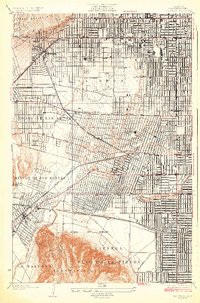
1926 Map of Hollywood
USGS Topo · Published 1926About this map
La Brea and the surrounding plains of west Los Angeles are depicted here during a pivotal era of urbanization and resource extraction. The landscape is a patchwork of emerging residential grids and industrial activity, notably the dense concentration of Oil Wells and the Fossil Pits that would become world-famous. Major transit arteries like Wilshire Boulevard and Santa Monica Boulevard define the region's movement, supported by the extensive Pacific Electric rail network connecting Sherman and Culver Junc.
Find a feature on this map
31 named features on this map. Tap any name to fly to it.
Don’t see what you’re looking for? This feature index may not catch every label — zoom into the map to look around manually.
Map Details
Editions of this 1926 Hollywood Map
2 editions found
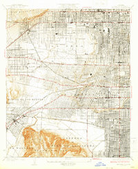
Other maps of this area

1894 · Los Angeles
USGS Topo · 1:62,500

1896 · Redondo
USGS Topo · 1:62,500

1896 · Santa Monica
USGS Topo · 1:62,500

1898 · Santa Monica
USGS Topo · 1:62,500

1900 · Los Angeles
USGS Topo · 1:62,500

1901 · Southern California Sheet No. 1
USGS Topo · 1:250,000

1902 · Santa Monica
USGS Topo · 1:62,500

1904 · Southern California Sheet No. 1
USGS Topo · 1:250,000

1920 · Santa Monica
USGS Topo · 1:62,500
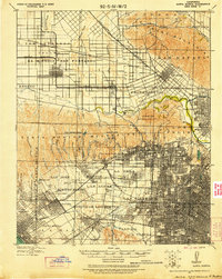
1921 · Santa Monica
USGS Topo · 1:62,500