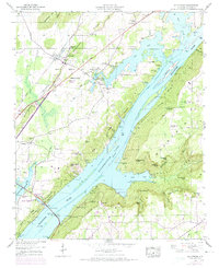
1947 Map of Hollywood
USGS Topo · Published 1974About this map
The Tennessee River dominates this mid-century landscape as it flows through the Guntersville Lake reservoir, creating a complex geography of inlets and islands. Along the western banks, the town of Hollywood sits at the foot of Backbone Ridge, serves as a key point on the Southern railroad line and the Lee Highway. Further south, the growing city of Scottsboro reaches its municipal boundary toward the water, where industrial infrastructure like a Pumping Station and Filtration Plant supports the local population.
Find a feature on this map
65 named features on this map. Tap any name to fly to it.
Don’t see what you’re looking for? This feature index may not catch every label — zoom into the map to look around manually.
Map Details
Editions of this 1947 Hollywood Map
4 editions found
Other maps of this area

1886 · Stevenson
USGS Topo · 1:125,000

1888 · Scottsboro
USGS Topo · 1:125,000

1892 · Scottsboro
USGS Topo · 1:125,000

1892 · Stevenson
USGS Topo · 1:125,000

1895 · Stevenson
USGS Topo · 1:125,000

1936 · Scottsboro
USGS Topo · 1:24,000

1936 · Wannville
USGS Topo · 1:24,000

1936 · Langston
USGS Topo · 1:24,000

1936 · Mud Creek
USGS Topo · 1:24,000

1936 · Dutton
USGS Topo · 1:24,000