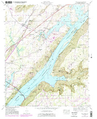
1947 Map of Hollywood
USGS Topo · Published 1981About this map
The Tennessee River corridor in Jackson County is defined here by the rising waters of Guntersville Lake and the industrial evolution of the shoreline. While the settlement of Hollywood sits inland along the Southern Railway, the riverbank itself shows significant modification, most notably the site of the Bellefonte Nuclear Plant listed as under construction. This energy infrastructure contrasts with the surrounding agricultural and rural landscape, where family heritage is preserved in numerous burial grounds like Sarratt Cem and Gant Cem.
Find a feature on this map
62 named features on this map. Tap any name to fly to it.
Don’t see what you’re looking for? This feature index may not catch every label — zoom into the map to look around manually.
Map Details
Editions of this 1947 Hollywood Map
4 editions found
Other maps of this area

1886 · Stevenson
USGS Topo · 1:125,000

1888 · Scottsboro
USGS Topo · 1:125,000

1892 · Scottsboro
USGS Topo · 1:125,000

1892 · Stevenson
USGS Topo · 1:125,000

1895 · Stevenson
USGS Topo · 1:125,000

1936 · Scottsboro
USGS Topo · 1:24,000

1936 · Wannville
USGS Topo · 1:24,000

1936 · Langston
USGS Topo · 1:24,000

1936 · Mud Creek
USGS Topo · 1:24,000

1936 · Dutton
USGS Topo · 1:24,000