
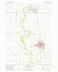
1978 Map of Holmes
USGS Topo · Published 1979About this map
Eagle Creek and its tributary Little Eagle Creek wind through this Wright County landscape, defining the topography between the settlements of Holmes and Florence. This 1970s survey captures a transition in rural transit and utility, showing extensive pipelines and multiple drainage projects including Ditch No 36 and Ditch No 9, which converted the prairie into productive farmland. The rail infrastructure is prominent, with the Chicago Rock Island and Pacific and the Chicago and North Western railroads intersecting the territory.
Find a feature on this map
28 named features on this map. Tap any name to fly to it.
Don’t see what you’re looking for? This feature index may not catch every label — zoom into the map to look around manually.
Map Details
Editions of this 1978 Holmes Map
This is the sole edition of this map. No revisions or reprints were ever made.
Other maps of this area

1954 · Waterloo
USGS Topo · 1:250,000

1955 · Waterloo
USGS Topo · 1:250,000

1972 · Kanawha SE
USGS Topo · 1:24,000

1972 · Cornelia
USGS Topo · 1:24,000

1972 · Renwick
USGS Topo · 1:24,000

1978 · Woolstock
USGS Topo · 1:24,000

1978 · Clarion
USGS Topo · 1:24,000

1978 · Eagle Grove SW
USGS Topo · 1:24,000

1978 · Clarion SW
USGS Topo · 1:24,000
1978 · Eagle Grove
USGS Topo · 1:24,000