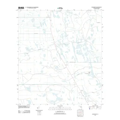
2012 Map of Holopaw SE
USGS Topo · Published 2012About this map
The low-lying wetlands of eastern Osceola County define this landscape, where the headwaters of Bull Creek and numerous sloughs dominate the geography. In the early 21st century, this area remains a mosaic of citrus groves and cattle ranching, illustrated by the presence of the Five T Ranch and the Tedford Ranch Airport. The settlement of Illahaw serves as a small anchor point along the highway corridor, surrounded by a complex network of seasonal water bodies such as Sawgrass Slough and Rattlesnake Slough. This region's hydrology is particularly intricate, featuring named depressions like Johnson Bay and Saplin Bay, along with distinctive cypress-lined ponds like Grape Head Pond and Cabbage Slough. The rural road network, including Donovan Crews Rd and Coaches Ln, provides access through the marshy terrain that feeds into the W Br Crabgrass Cr and the wider St. Johns River watershed.
Find a feature on this map
32 named features on this map. Tap any name to fly to it.
Don’t see what you’re looking for? This feature index may not catch every label — zoom into the map to look around manually.
Map Details
Editions of this 2012 Holopaw SE Map
This is the sole edition of this map. No revisions or reprints were ever made.
Other maps of this area

1953 · Lake Marian NW
USGS Topo · 1:24,000

1953 · Holopaw SE
USGS Topo · 1:24,000

1953 · Kenansville
USGS Topo · 1:24,000

1953 · Deer Park NW
USGS Topo · 1:24,000

1953 · Holopaw SW
USGS Topo · 1:24,000

1953 · Deer Park
USGS Topo · 1:24,000

1953 · Ashton
USGS Topo · 1:24,000

1953 · Holopaw
USGS Topo · 1:24,000

1953 · Lake Marian NE
USGS Topo · 1:24,000

1955 · Orlando
USGS Topo · 1:250,000