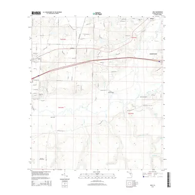
2015 Map of Holt
USGS Topo · Published 2015About this map
The Yellow River and Shoal River converge in this section of the Florida Panhandle, defining a landscape of wetlands and prominent river elevations. Settled areas like Holt and Galliver are situated north of the river basins, connected by a network of timber-era roads such as Keyser Mill Rd and Saw Mill Rd. The map documents a blend of recreation and military presence, featuring a segment of the Florida National Scenic Trail winding through the river valley, while the Eglin Test Site B6 Airport and Yellow River Airstrip mark the southern reach of the territory. Notable bluffs, including Wilkinson Bluff and Rattlesnake Bluff, overlook the meandering waterways. Genealogists can locate several local burial sites, such as Beulah Cem and Carr Cem, which remain as lasting markers of the rural communities established along these Northwest Florida riverbanks.
Find a feature on this map
94 named features on this map. Tap any name to fly to it.
Don’t see what you’re looking for? This feature index may not catch every label — zoom into the map to look around manually.
Map Details
Editions of this 2015 Holt Map
This is the sole edition of this map. No revisions or reprints were ever made.
Other maps of this area

1934 · Holt
USGS Topo · 1:48,000

1934 · Harold
USGS Topo · 1:62,500

1937 · Holt
USGS Topo · 1:62,500

1937 · Harold
USGS Topo · 1:62,500

1938 · Harold
USGS Topo · 1:62,500

1948 · Munson
USGS Topo · 1:62,500

1949 · Crestview
USGS Topo · 1:62,500

1950 · Munson
USGS Topo · 1:62,500

1951 · Crestview
USGS Topo · 1:62,500

1956 · Holt
USGS Topo · 1:62,500