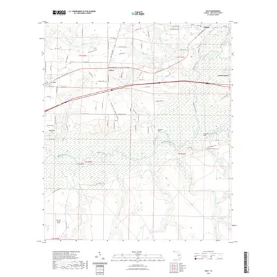
2021 Map of Holt
USGS Topo · Published 2021About this map
The Yellow River winds through the heart of the Florida Panhandle, defining a landscape of riverine bluffs and low-lying wetlands. Along its banks, prominent elevations such as Metts Bluff, Wilkinson Bluff, and Rattlesnake Bluff provide relief from the surrounding bottomlands. The settlement of Holt and the smaller community at Galliver serve as local hubs, connected by the modern corridor of Interstate 10 and the older Us 90 Connector Trl.
Find a feature on this map
95 named features on this map. Tap any name to fly to it.
Don’t see what you’re looking for? This feature index may not catch every label — zoom into the map to look around manually.
Map Details
Editions of this 2021 Holt Map
This is the sole edition of this map. No revisions or reprints were ever made.
Other maps of this area

1934 · Holt
USGS Topo · 1:48,000

1934 · Harold
USGS Topo · 1:62,500

1937 · Holt
USGS Topo · 1:62,500

1937 · Harold
USGS Topo · 1:62,500

1938 · Harold
USGS Topo · 1:62,500

1948 · Munson
USGS Topo · 1:62,500

1949 · Crestview
USGS Topo · 1:62,500

1950 · Munson
USGS Topo · 1:62,500

1951 · Crestview
USGS Topo · 1:62,500

1956 · Holt
USGS Topo · 1:62,500