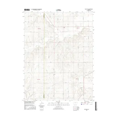
2015 Map of Holton SE
USGS Topo · Published 2015About this map
The boundary between Jackson and Jefferson Counties bisects this rural landscape, which is defined by a dendritic network of streams and well-ordered section lines. The settlement of Bloomfield serves as a small geographic anchor in the southern half of the quadrangle, situated near the Bloomfield Cemetery. The terrain is deeply carved by watercourses including N Cedar Creek, S Cedar Creek, and Duck Creek, which flow through the agricultural hills.
Find a feature on this map
42 named features on this map. Tap any name to fly to it.
Don’t see what you’re looking for? This feature index may not catch every label — zoom into the map to look around manually.
Map Details
Editions of this 2015 Holton SE Map
This is the sole edition of this map. No revisions or reprints were ever made.
Other maps of this area

1886 · Oskaloosa
USGS Topo · 1:125,000

1888 · Oskaloosa
USGS Topo · 1:125,000

1889 · Topeka
USGS Topo · 1:125,000

1894 · Oskaloosa
USGS Topo · 1:125,000

1894 · Topeka
USGS Topo · 1:125,000

1950 · Kansas City
USGS Topo · 1:250,000

1951 · Ozawkie
USGS Topo · 1:24,000

1952 · Elmont
USGS Topo · 1:24,000
1952 · Meriden
USGS Topo · 1:24,000

1954 · Kansas City
USGS Topo · 1:250,000