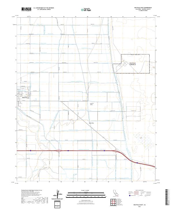
2021 Map of Holtville East
USGS Topo · Published 2021About this map
Holtville and the neighboring settlement of Date City serve as the focal points for this eastern Imperial Valley landscape, where the transition from intensive agriculture to the arid desert of East Mesa is clearly defined. The environment is shaped by an intricate network of irrigation and drainage infrastructure, with labels such as the Holtville Main Drain, Pear Canal, and Ninth Street Ditch illustrating the sophisticated water management required for desert farming. Transport is anchored by the Evan Hewes Hwy, which cuts across the lower half of the quadrangle.
Find a feature on this map
115 named features on this map. Tap any name to fly to it.
Don’t see what you’re looking for? This feature index may not catch every label — zoom into the map to look around manually.
Map Details
Editions of this 2021 Holtville East Map
This is the sole edition of this map. No revisions or reprints were ever made.
Other maps of this area

1907 · Holtville
USGS Topo · 1:125,000

1940 · Alamorio
USGS Topo · 1:62,500

1940 · Calexico
USGS Topo · 1:62,500

1942 · El Centro
USGS Topo · 1:250,000

1943 · Calexico
USGS Topo · 1:62,500

1945 · Alamorio
USGS Topo · 1:62,500
1953 · Calexico
USGS Topo · 1:50,000

1954 · El Centro
USGS Topo · 1:250,000

1954 · Midway Well NW
USGS Topo · 1:24,000
1954 · Glamis SW
USGS Topo · 1:24,000