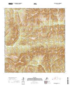
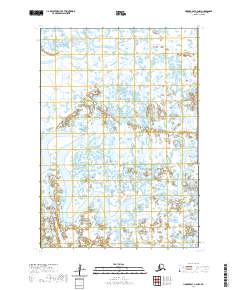
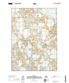
2017 Map of Holy Cross A-5 SE
USGS Topo · Published 2017About this map
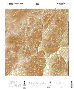
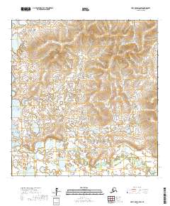
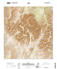
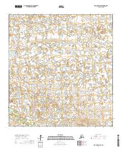
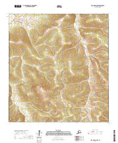
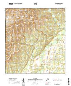
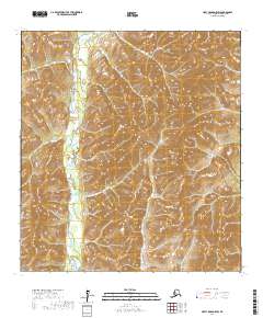
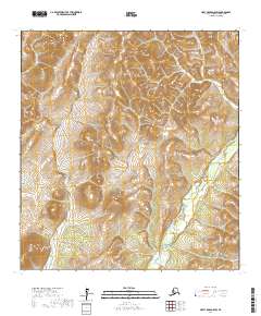
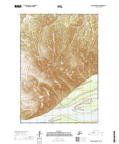
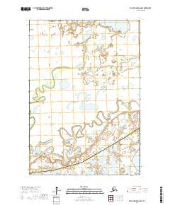
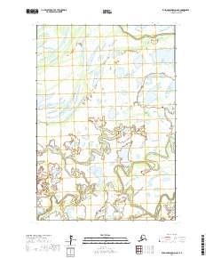
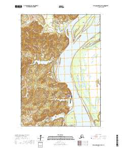
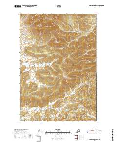
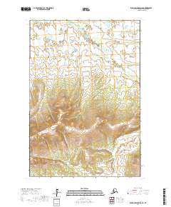
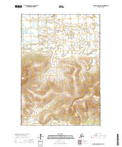
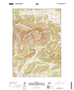
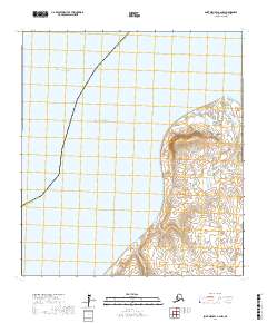
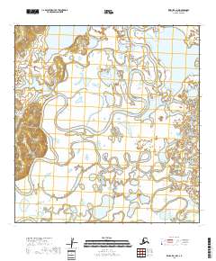
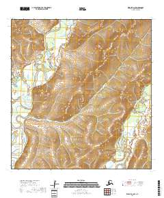
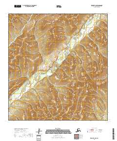
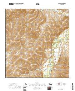
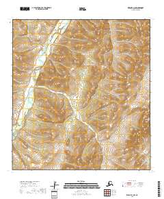
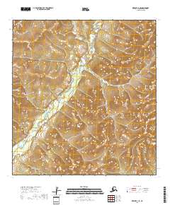
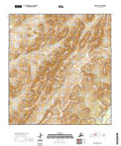
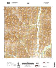
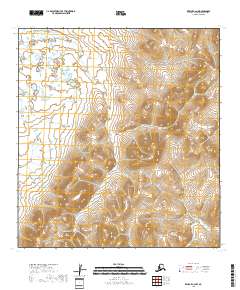
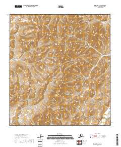
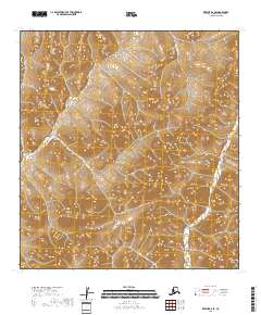
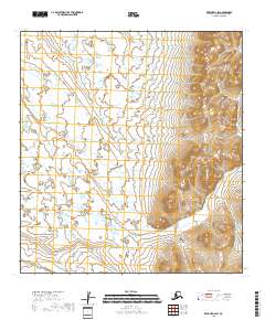
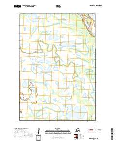
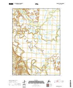
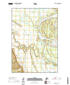
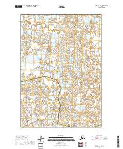
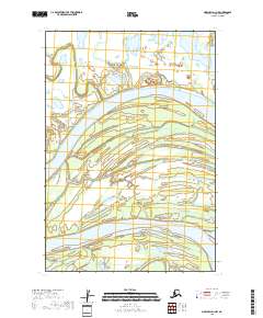
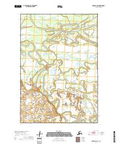
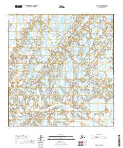
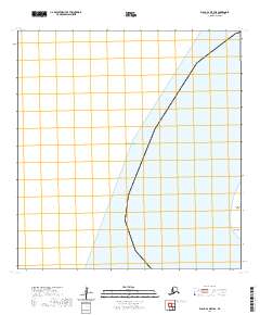
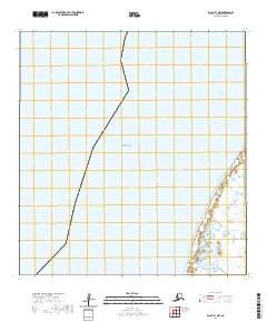
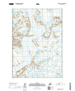
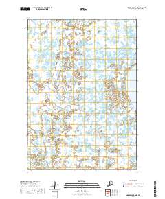
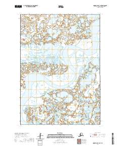
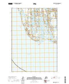
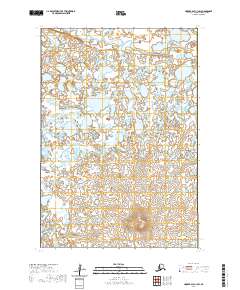
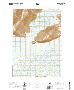
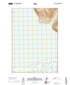
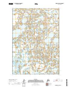
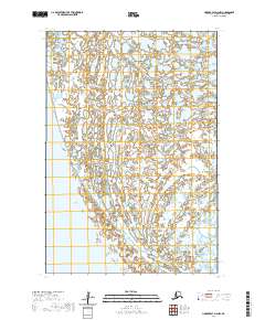
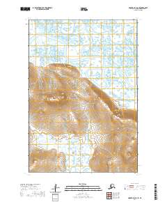
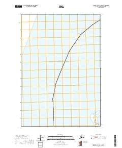
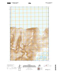
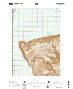
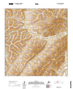
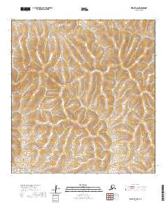
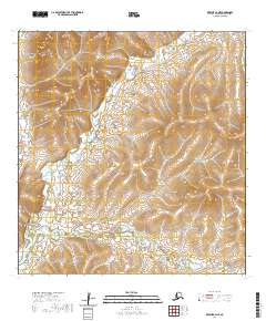
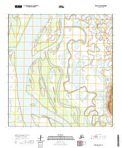
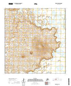
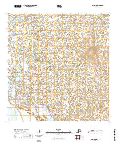
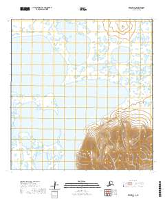
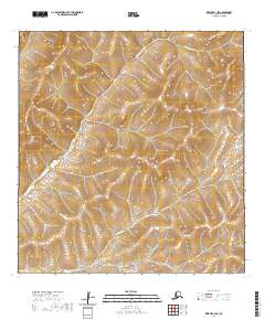
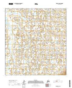
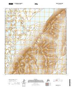
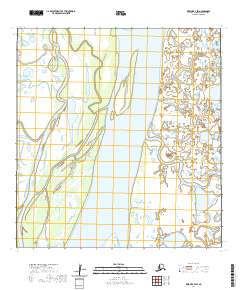
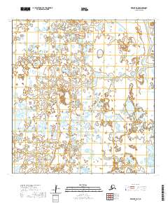
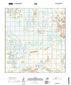
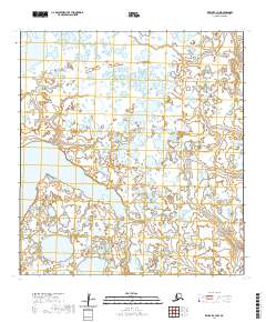
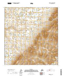
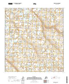
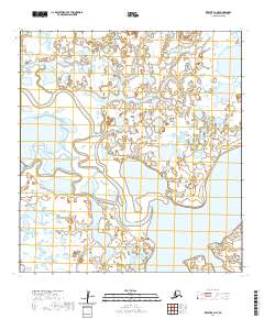
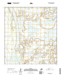
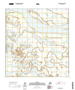
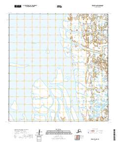
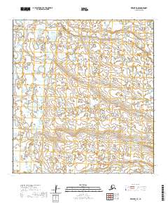
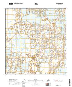
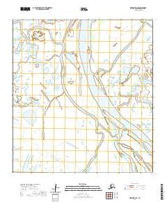
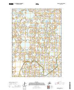
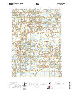
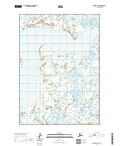
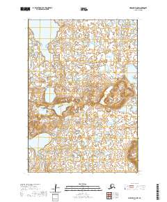
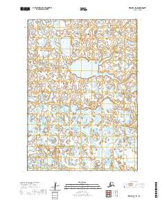
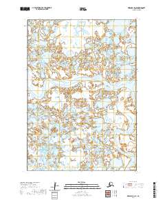
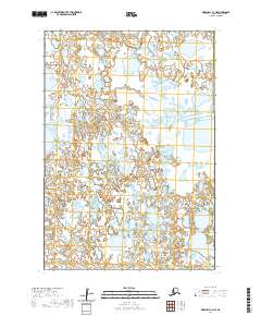
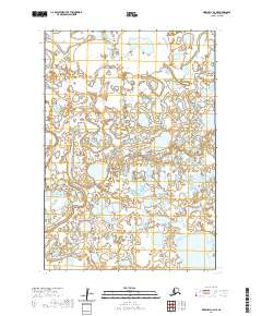
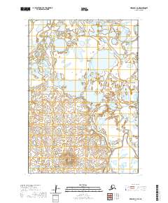
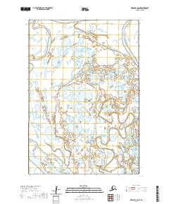
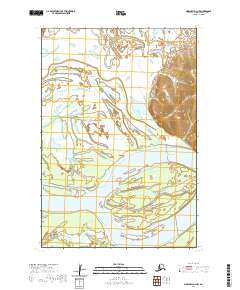
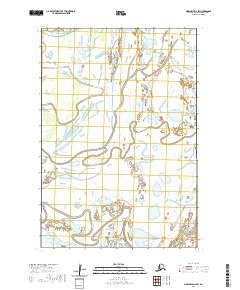
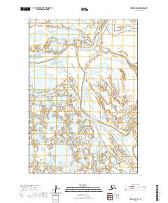
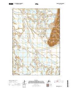
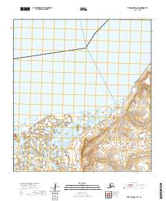
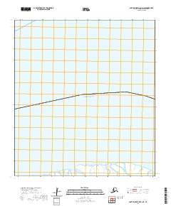
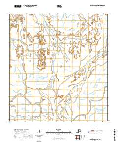
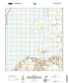
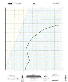
Ilivit Mountains and the surrounding river systems define this interior Alaskan landscape within the Kusilvak Census Area. The topography is dominated by the Stuyahok River winding through the northeastern sector, while the Kako Cr drainage appears in the western portion of the quadrangle. Significant elevation changes are marked by Chase Mtn on the eastern boundary. This 2017 data, compiled from sources including the U.S. Geological Survey and the BLM, illustrates a region defined by its hydrography and high terrain rather than human infrastructure or road networks. The map provides a detailed view of township and range lines across several sections, including t24n r65w and t23n r64w, offering a precise look at the land survey system in this part of Alaska.
Find a feature on this map
10 named features on this map. Tap any name to fly to it.
Don’t see what you’re looking for? This feature index may not catch every label — zoom into the map to look around manually.
Map Details
Editions of this 2017 Holy Cross A-5 SE Map
This is the sole edition of this map. No revisions or reprints were ever made.
Historical Maps of Unorganized Borough Through Time
411 maps found

1951 Black
Kusilvak Borough, AK

1951 Holy Cross A-5
Kusilvak Borough, AK

1951 St Michael
Kusilvak Borough, AK

1952 Black A-1
Kusilvak Borough, AK

1952 Black A-2
Kusilvak Borough, AK

1952 Black B-1
Kusilvak Borough, AK

1952 Black C-1
Kusilvak Borough, AK

1952 Holy Cross A-5
Kusilvak Borough, AK

1952 Holy Cross A-6
Kusilvak Borough, AK

1952 Holy Cross B-5
Kusilvak Borough, AK

1952 Holy Cross B-6
Kusilvak Borough, AK

1952 Holy Cross C-5
Kusilvak Borough, AK

1952 Holy Cross C-6
Kusilvak Borough, AK

1952 Holy Cross D-5
Kusilvak Borough, AK

1952 Holy Cross D-6
Kusilvak Borough, AK

1952 Hooper Bay A-2
Kusilvak Borough, AK

1952 Hooper Bay B-3
Kusilvak Borough, AK

1952 Hooper Bay C-1
Kusilvak Borough, AK

1952 Hooper Bay C-3
Kusilvak Borough, AK

1952 Hooper Bay C-4
Kusilvak Borough, AK

1952 Hooper Bay D-1
Kusilvak Borough, AK

1952 Hooper Bay D-2
Kusilvak Borough, AK

1952 Kwiguk A-1
Kusilvak Borough, AK

1952 Kwiguk A-2
Kusilvak Borough, AK

1952 Kwiguk A-3
Kusilvak Borough, AK

1952 Kwiguk A-4
Kusilvak Borough, AK

1952 Kwiguk A-5
Kusilvak Borough, AK

1952 Kwiguk A-6
Kusilvak Borough, AK

1952 Kwiguk B-1
Kusilvak Borough, AK

1952 Kwiguk B-2
Kusilvak Borough, AK
1952 Kwiguk B-3
Kusilvak Borough, AK

1952 Kwiguk B-4
Kusilvak Borough, AK

1952 Kwiguk B-5
Kusilvak Borough, AK

1952 Kwiguk B-6
Kusilvak Borough, AK

1952 Kwiguk C-1
Kusilvak Borough, AK

1952 Kwiguk C-2
Kusilvak Borough, AK

1952 Kwiguk C-3
Kusilvak Borough, AK

1952 Kwiguk C-4
Kusilvak Borough, AK

1952 Kwiguk C-5
Kusilvak Borough, AK

1952 Kwiguk C-6
Kusilvak Borough, AK

1952 Kwiguk D-1
Kusilvak Borough, AK

1952 Kwiguk D-2
Kusilvak Borough, AK

1952 Kwiguk D-3
Kusilvak Borough, AK

1952 Kwiguk D-4
Kusilvak Borough, AK

1952 Kwiguk D-5
Kusilvak Borough, AK

1952 Kwiguk D-6
Kusilvak Borough, AK

1952 Kwiguk
Kusilvak Borough, AK

1952 Marshall C-1
Kusilvak Borough, AK

1952 Marshall C-5
Kusilvak Borough, AK

1952 Marshall C-6
Kusilvak Borough, AK

1952 Marshall C-7
Kusilvak Borough, AK

1952 Marshall C-8
Kusilvak Borough, AK

1952 Marshall D-1
Kusilvak Borough, AK

1952 Marshall D-2
Kusilvak Borough, AK

1952 Marshall D-3
Kusilvak Borough, AK

1952 Marshall D-4
Kusilvak Borough, AK

1952 Marshall D-5
Kusilvak Borough, AK

1952 Marshall D-6
Kusilvak Borough, AK

1952 Marshall D-7
Kusilvak Borough, AK

1952 Marshall D-8
Kusilvak Borough, AK

1952 Russian Mission C-7
Kusilvak Borough, AK

1952 Russian Mission C-8
Kusilvak Borough, AK

1952 Russian Mission D-5
Kusilvak Borough, AK

1952 Russian Mission D-6
Kusilvak Borough, AK

1952 Russian Mission D-7
Kusilvak Borough, AK

1952 Russian Mission D-8
Kusilvak Borough, AK

1952 Saint Michael A-1
Kusilvak Borough, AK

1952 Saint Michael A-2
Kusilvak Borough, AK

1952 Saint Michael A-3
Kusilvak Borough, AK

1952 Saint Michael A-4
Kusilvak Borough, AK

1952 Saint Michael A-5
Kusilvak Borough, AK

1952 Saint Michael A-6
Kusilvak Borough, AK

1952 St Michael
Kusilvak Borough, AK

1953 Hooper Bay B-1
Kusilvak Borough, AK

1953 Hooper Bay B-2
Kusilvak Borough, AK

1953 Hooper Bay C-2
Kusilvak Borough, AK

1953 Hooper Bay D-3
Kusilvak Borough, AK

1953 Marshall B-5
Kusilvak Borough, AK

1953 Marshall B-6
Kusilvak Borough, AK

1953 Marshall B-7
Kusilvak Borough, AK

1953 Marshall B-8
Kusilvak Borough, AK

1954 Hooper Bay A-1
Kusilvak Borough, AK

1954 Marshall A-7
Kusilvak Borough, AK

1954 Marshall A-8
Kusilvak Borough, AK

1954 Marshall C-2
Kusilvak Borough, AK

1954 Marshall C-3
Kusilvak Borough, AK

1954 Marshall C-4
Kusilvak Borough, AK

1957 Marshall B-7
Kusilvak Borough, AK

1964 St. Michael
Kusilvak Borough, AK
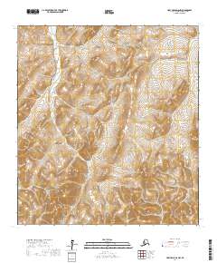
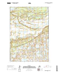
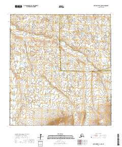
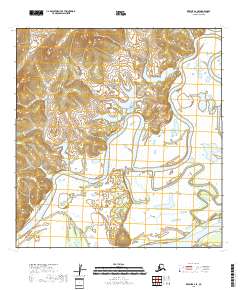
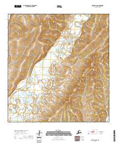
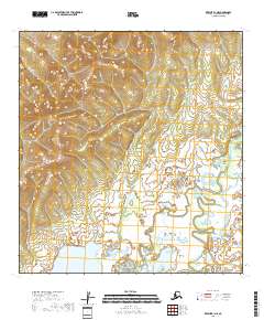
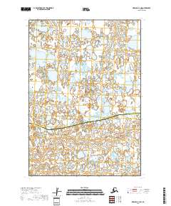
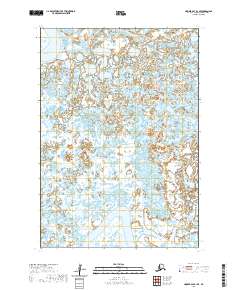
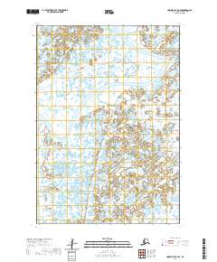
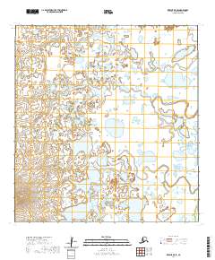
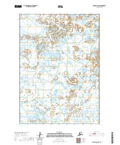
2017 Holy Cross A-5 NE
Kusilvak Borough, AK
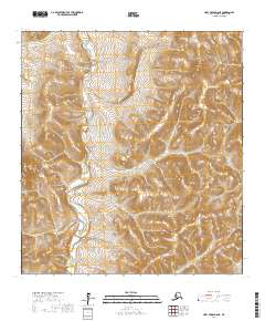
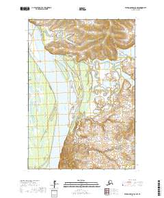
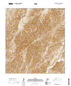
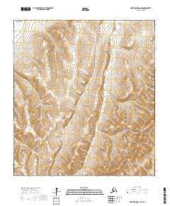
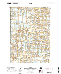
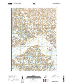
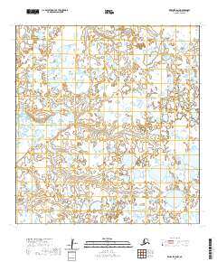
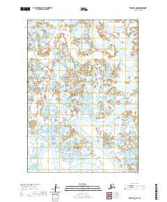
2017 Holy Cross A-5 NW
Kusilvak Borough, AK
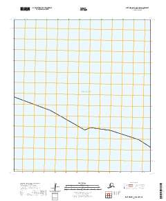
2017 Holy Cross A-5 SE
Kusilvak Borough, AK
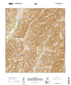
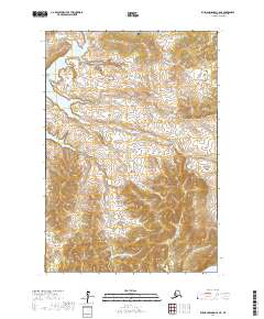
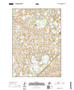
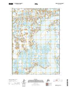
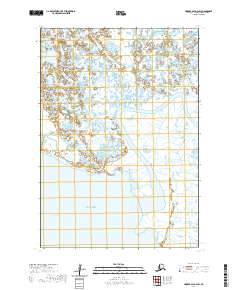
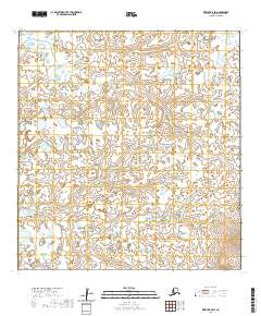
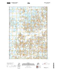
2017 Holy Cross A-5 SW
Kusilvak Borough, AK
2017 Holy Cross A-6 NE
Kusilvak Borough, AK
2017 Holy Cross A-6 NW
Kusilvak Borough, AK
2017 Holy Cross A-6 SE
Kusilvak Borough, AK
2017 Holy Cross A-6 SW
Kusilvak Borough, AK
2017 Holy Cross B-5 NE
Kusilvak Borough, AK
2017 Holy Cross B-5 NW
Kusilvak Borough, AK
2017 Holy Cross B-5 SE
Kusilvak Borough, AK
2017 Holy Cross B-5 SW
Kusilvak Borough, AK
2017 Holy Cross B-6 NE
Kusilvak Borough, AK
2017 Holy Cross B-6 NW
Kusilvak Borough, AK
2017 Holy Cross B-6 SE
Kusilvak Borough, AK
2017 Holy Cross B-6 SW
Kusilvak Borough, AK
2017 Holy Cross C-5 NE
Kusilvak Borough, AK
2017 Holy Cross C-5 NW
Kusilvak Borough, AK
2017 Holy Cross C-5 SE
Kusilvak Borough, AK
2017 Holy Cross C-5 SW
Kusilvak Borough, AK
2017 Holy Cross C-6 NE
Kusilvak Borough, AK
2017 Holy Cross C-6 NW
Kusilvak Borough, AK
2017 Holy Cross C-6 SE
Kusilvak Borough, AK
2017 Holy Cross C-6 SW
Kusilvak Borough, AK
2017 Holy Cross D-5 NE
Kusilvak Borough, AK
2017 Holy Cross D-5 NW
Kusilvak Borough, AK
2017 Holy Cross D-5 SE
Kusilvak Borough, AK
2017 Holy Cross D-5 SW
Kusilvak Borough, AK
2017 Holy Cross D-6 NE
Kusilvak Borough, AK
2017 Holy Cross D-6 NW
Kusilvak Borough, AK
2017 Holy Cross D-6 SE
Kusilvak Borough, AK
2017 Holy Cross D-6 SW
Kusilvak Borough, AK
2017 Russian Mission C-6 NE
Kusilvak Borough, AK
2017 Russian Mission C-6 NW
Kusilvak Borough, AK
2017 Russian Mission C-7 NE
Kusilvak Borough, AK
2017 Russian Mission C-7 NW
Kusilvak Borough, AK
2017 Russian Mission C-7 SW
Kusilvak Borough, AK
2017 Russian Mission C-8 NE
Kusilvak Borough, AK
2017 Russian Mission C-8 NW
Kusilvak Borough, AK
2017 Russian Mission C-8 SE
Kusilvak Borough, AK
2017 Russian Mission C-8 SW
Kusilvak Borough, AK
2017 Russian Mission D-5 NE
Kusilvak Borough, AK
2017 Russian Mission D-5 NW
Kusilvak Borough, AK
2017 Russian Mission D-5 SE
Kusilvak Borough, AK
2017 Russian Mission D-5 SW
Kusilvak Borough, AK
2017 Russian Mission D-6 NE
Kusilvak Borough, AK
2017 Russian Mission D-6 NW
Kusilvak Borough, AK
2017 Russian Mission D-6 SE
Kusilvak Borough, AK
2017 Russian Mission D-6 SW
Kusilvak Borough, AK
2017 Russian Mission D-7 NE
Kusilvak Borough, AK
2017 Russian Mission D-7 NW
Kusilvak Borough, AK
2017 Russian Mission D-7 SE
Kusilvak Borough, AK
2017 Russian Mission D-7 SW
Kusilvak Borough, AK
2017 Russian Mission D-8 NE
Kusilvak Borough, AK
2017 Russian Mission D-8 NW
Kusilvak Borough, AK
2017 Russian Mission D-8 SE
Kusilvak Borough, AK

2017 Russian Mission D-8 SW
Kusilvak Borough, AK
2017 Saint Michael A-1 NW
Kusilvak Borough, AK
2017 Saint Michael A-1 SE
Kusilvak Borough, AK
2017 Saint Michael A-1 SW
Kusilvak Borough, AK

2017 Saint Michael A-2 NE
Kusilvak Borough, AK
2017 Saint Michael A-2 NW
Kusilvak Borough, AK
2017 Saint Michael A-2 SE
Kusilvak Borough, AK
2017 Saint Michael A-2 SW
Kusilvak Borough, AK
2018 Kwiguk A-1 NE
Kusilvak Borough, AK
2018 Kwiguk A-1 NW
Kusilvak Borough, AK
2018 Kwiguk A-1 SE
Kusilvak Borough, AK
2018 Kwiguk A-1 SW
Kusilvak Borough, AK
2018 Kwiguk A-2 NE
Kusilvak Borough, AK
2018 Kwiguk A-2 NW
Kusilvak Borough, AK
2018 Kwiguk A-2 SE
Kusilvak Borough, AK
2018 Kwiguk A-2 SW
Kusilvak Borough, AK
2018 Kwiguk B-1 NE
Kusilvak Borough, AK
2018 Kwiguk B-1 NW
Kusilvak Borough, AK
2018 Kwiguk B-1 SE
Kusilvak Borough, AK
2018 Kwiguk B-1 SW
Kusilvak Borough, AK
2018 Kwiguk B-2 NE
Kusilvak Borough, AK
2018 Kwiguk B-2 NW
Kusilvak Borough, AK
2018 Kwiguk B-2 SE
Kusilvak Borough, AK
2018 Kwiguk B-2 SW
Kusilvak Borough, AK
2018 Kwiguk C-1 NE
Kusilvak Borough, AK
2018 Kwiguk C-1 NW
Kusilvak Borough, AK
2018 Kwiguk C-1 SE
Kusilvak Borough, AK
2018 Kwiguk C-1 SW
Kusilvak Borough, AK
2018 Kwiguk C-2 NE
Kusilvak Borough, AK
2018 Kwiguk C-2 NW
Kusilvak Borough, AK
2018 Kwiguk C-2 SE
Kusilvak Borough, AK
2018 Kwiguk C-2 SW
Kusilvak Borough, AK
2018 Kwiguk D-1 NE
Kusilvak Borough, AK
2018 Kwiguk D-1 NW
Kusilvak Borough, AK
2018 Kwiguk D-1 SE
Kusilvak Borough, AK
2018 Kwiguk D-1 SW
Kusilvak Borough, AK

2018 Kwiguk D-2 NE
Kusilvak Borough, AK
2018 Kwiguk D-2 NW
Kusilvak Borough, AK
2018 Kwiguk D-2 SE
Kusilvak Borough, AK
2018 Kwiguk D-2 SW
Kusilvak Borough, AK
2018 Marshall C-1 NE
Kusilvak Borough, AK
2018 Marshall C-1 NW
Kusilvak Borough, AK
2018 Marshall C-1 SE
Kusilvak Borough, AK
2018 Marshall C-1 SW
Kusilvak Borough, AK
2018 Marshall C-2 NE
Kusilvak Borough, AK
2018 Marshall C-2 NW
Kusilvak Borough, AK
2018 Marshall C-2 SE
Kusilvak Borough, AK
2018 Marshall C-2 SW
Kusilvak Borough, AK
2018 Marshall C-3 NE
Kusilvak Borough, AK
2018 Marshall C-3 SE
Kusilvak Borough, AK

2018 Marshall D-1 NE
Kusilvak Borough, AK
2018 Marshall D-1 NW
Kusilvak Borough, AK

2018 Marshall D-1 SE
Kusilvak Borough, AK
2018 Marshall D-1 SW
Kusilvak Borough, AK
2018 Marshall D-2 NE
Kusilvak Borough, AK
2018 Marshall D-2 NW
Kusilvak Borough, AK
2018 Marshall D-2 SE
Kusilvak Borough, AK
2018 Marshall D-2 SW
Kusilvak Borough, AK

2018 Marshall D-3 NE
Kusilvak Borough, AK
2018 Marshall D-3 SE
Kusilvak Borough, AK
2020 Black A-1 NE
Kusilvak Borough, AK
2020 Black A-1 NW
Kusilvak Borough, AK
2020 Black A-1 SE
Kusilvak Borough, AK
2020 Black A-1 SW
Kusilvak Borough, AK
2020 Black A-2 NE
Kusilvak Borough, AK
2020 Black A-2 OE W SE
Kusilvak Borough, AK
2020 Black A-2 SE
Kusilvak Borough, AK
2020 Black A-2 SW
Kusilvak Borough, AK
2020 Black B-1 NE
Kusilvak Borough, AK
2020 Black B-1 NW
Kusilvak Borough, AK
2020 Black B-1 OE W SE
Kusilvak Borough, AK
2020 Black B-1 SE
Kusilvak Borough, AK

2020 Black B-1 SW
Kusilvak Borough, AK
2020 Black C-1 SE
Kusilvak Borough, AK
2020 Hooper Bay A-1 NE
Kusilvak Borough, AK
2020 Hooper Bay A-1 NW
Kusilvak Borough, AK
2020 Hooper Bay A-1 SE
Kusilvak Borough, AK
2020 Hooper Bay A-1 SW
Kusilvak Borough, AK
2020 Hooper Bay A-2 NE
Kusilvak Borough, AK
2020 Hooper Bay A-2 NW
Kusilvak Borough, AK
2020 Hooper Bay A-2 SE
Kusilvak Borough, AK
2020 Hooper Bay A-2 SW
Kusilvak Borough, AK
2020 Hooper Bay B-1 NE
Kusilvak Borough, AK
2020 Hooper Bay B-1 NW
Kusilvak Borough, AK
2020 Hooper Bay B-1 SE
Kusilvak Borough, AK
2020 Hooper Bay B-1 SW
Kusilvak Borough, AK

2020 Hooper Bay B-2 NE
Kusilvak Borough, AK
2020 Hooper Bay B-2 NW
Kusilvak Borough, AK
2020 Hooper Bay B-2 SE
Kusilvak Borough, AK
2020 Hooper Bay B-2 SW
Kusilvak Borough, AK
2020 Hooper Bay B-3 NE
Kusilvak Borough, AK

2020 Hooper Bay B-3 NW
Kusilvak Borough, AK
2020 Hooper Bay B-3 SE
Kusilvak Borough, AK
2020 Hooper Bay C-1 NE
Kusilvak Borough, AK
2020 Hooper Bay C-1 NW
Kusilvak Borough, AK
2020 Hooper Bay C-1 SE
Kusilvak Borough, AK
2020 Hooper Bay C-1 SW
Kusilvak Borough, AK
2020 Hooper Bay C-2 NE
Kusilvak Borough, AK
2020 Hooper Bay C-2 NW
Kusilvak Borough, AK
2020 Hooper Bay C-2 SE
Kusilvak Borough, AK

2020 Hooper Bay C-2 SW
Kusilvak Borough, AK
2020 Hooper Bay C-3 NE
Kusilvak Borough, AK
2020 Hooper Bay C-3 NW
Kusilvak Borough, AK

2020 Hooper Bay C-3 SE
Kusilvak Borough, AK

2020 Hooper Bay C-3 SW
Kusilvak Borough, AK
2020 Hooper Bay C-4 NE
Kusilvak Borough, AK

2020 Hooper Bay C-4 SE
Kusilvak Borough, AK
2020 Hooper Bay D-1 NE
Kusilvak Borough, AK
2020 Hooper Bay D-1 NW
Kusilvak Borough, AK
2020 Hooper Bay D-1 SE
Kusilvak Borough, AK
2020 Hooper Bay D-1 SW
Kusilvak Borough, AK
2020 Hooper Bay D-2 NE
Kusilvak Borough, AK
2020 Hooper Bay D-2 NW
Kusilvak Borough, AK
2020 Hooper Bay D-2 SE
Kusilvak Borough, AK

2020 Hooper Bay D-2 SW
Kusilvak Borough, AK
2020 Hooper Bay D-3 NE
Kusilvak Borough, AK
2020 Hooper Bay D-3 NW
Kusilvak Borough, AK
2020 Hooper Bay D-3 OE W SE
Kusilvak Borough, AK
2020 Hooper Bay D-3 SE
Kusilvak Borough, AK
2020 Hooper Bay D-3 SW
Kusilvak Borough, AK
2020 Kwiguk A-3 NE
Kusilvak Borough, AK
2020 Kwiguk A-3 NW
Kusilvak Borough, AK

2020 Kwiguk A-3 SE
Kusilvak Borough, AK

2020 Kwiguk A-3 SW
Kusilvak Borough, AK
2020 Kwiguk A-4 NE
Kusilvak Borough, AK
2020 Kwiguk A-4 NW
Kusilvak Borough, AK

2020 Kwiguk A-4 SE
Kusilvak Borough, AK

2020 Kwiguk A-4 SW
Kusilvak Borough, AK
2020 Kwiguk A-5 NE
Kusilvak Borough, AK
2020 Kwiguk A-5 NW
Kusilvak Borough, AK
2020 Kwiguk A-5 SE
Kusilvak Borough, AK
2020 Kwiguk A-5 SW
Kusilvak Borough, AK
2020 Kwiguk A-6 NE
Kusilvak Borough, AK

2020 Kwiguk A-6 NW
Kusilvak Borough, AK
2020 Kwiguk A-6 SE
Kusilvak Borough, AK
2020 Kwiguk A-6 SW
Kusilvak Borough, AK
2020 Kwiguk B-3 NE
Kusilvak Borough, AK

2020 Kwiguk B-3 NW
Kusilvak Borough, AK
2020 Kwiguk B-3 SE
Kusilvak Borough, AK
2020 Kwiguk B-3 SW
Kusilvak Borough, AK
2020 Kwiguk B-4 NE
Kusilvak Borough, AK

2020 Kwiguk B-4 NW
Kusilvak Borough, AK
2020 Kwiguk B-4 SE
Kusilvak Borough, AK
2020 Kwiguk B-4 SW
Kusilvak Borough, AK
2020 Kwiguk B-5 NE
Kusilvak Borough, AK
2020 Kwiguk B-5 NW
Kusilvak Borough, AK
2020 Kwiguk B-5 SE
Kusilvak Borough, AK
2020 Kwiguk B-5 SW
Kusilvak Borough, AK
2020 Kwiguk B-6 NE
Kusilvak Borough, AK

2020 Kwiguk B-6 NW
Kusilvak Borough, AK
2020 Kwiguk B-6 SE
Kusilvak Borough, AK
2020 Kwiguk B-6 SW
Kusilvak Borough, AK
2020 Kwiguk C-3 NE
Kusilvak Borough, AK
2020 Kwiguk C-3 NW
Kusilvak Borough, AK
2020 Kwiguk C-3 SE
Kusilvak Borough, AK
2020 Kwiguk C-3 SW
Kusilvak Borough, AK
2020 Kwiguk C-4 NE
Kusilvak Borough, AK
2020 Kwiguk C-4 NW
Kusilvak Borough, AK
2020 Kwiguk C-4 SE
Kusilvak Borough, AK
2020 Kwiguk C-4 SW
Kusilvak Borough, AK
2020 Kwiguk C-5 NE
Kusilvak Borough, AK
2020 Kwiguk C-5 NW
Kusilvak Borough, AK
2020 Kwiguk C-5 SE
Kusilvak Borough, AK
2020 Kwiguk C-5 SW
Kusilvak Borough, AK
2020 Kwiguk C-6 NE
Kusilvak Borough, AK
2020 Kwiguk C-6 NW
Kusilvak Borough, AK
2020 Kwiguk C-6 SE
Kusilvak Borough, AK

2020 Kwiguk C-6 SW
Kusilvak Borough, AK
2020 Kwiguk D-3 NE
Kusilvak Borough, AK
2020 Kwiguk D-3 NW
Kusilvak Borough, AK
2020 Kwiguk D-3 SE
Kusilvak Borough, AK
2020 Kwiguk D-3 SW
Kusilvak Borough, AK
2020 Kwiguk D-4 NE
Kusilvak Borough, AK
2020 Kwiguk D-4 NW
Kusilvak Borough, AK
2020 Kwiguk D-4 SE
Kusilvak Borough, AK
2020 Kwiguk D-4 SW
Kusilvak Borough, AK
2020 Kwiguk D-5 NE
Kusilvak Borough, AK
2020 Kwiguk D-5 NW
Kusilvak Borough, AK
2020 Kwiguk D-5 SE
Kusilvak Borough, AK

2020 Kwiguk D-5 SW
Kusilvak Borough, AK
2020 Kwiguk D-6 NE
Kusilvak Borough, AK
2020 Kwiguk D-6 NW
Kusilvak Borough, AK

2020 Kwiguk D-6 SE
Kusilvak Borough, AK
2020 Kwiguk D-6 SW
Kusilvak Borough, AK
2020 Marshall A-6 NW
Kusilvak Borough, AK
2020 Marshall A-7 NE
Kusilvak Borough, AK
2020 Marshall A-7 NW
Kusilvak Borough, AK
2020 Marshall A-7 SE
Kusilvak Borough, AK
2020 Marshall A-7 SW
Kusilvak Borough, AK
2020 Marshall A-8 NE
Kusilvak Borough, AK
2020 Marshall A-8 NW
Kusilvak Borough, AK
2020 Marshall A-8 SE
Kusilvak Borough, AK
2020 Marshall A-8 SW
Kusilvak Borough, AK
2020 Marshall B-5 NE
Kusilvak Borough, AK
2020 Marshall B-5 NW
Kusilvak Borough, AK
2020 Marshall B-6 NE
Kusilvak Borough, AK
2020 Marshall B-6 NW
Kusilvak Borough, AK
2020 Marshall B-6 SW
Kusilvak Borough, AK
2020 Marshall B-7 NE
Kusilvak Borough, AK
2020 Marshall B-7 NW
Kusilvak Borough, AK
2020 Marshall B-7 SE
Kusilvak Borough, AK
2020 Marshall B-7 SW
Kusilvak Borough, AK
2020 Marshall B-8 NE
Kusilvak Borough, AK
2020 Marshall B-8 NW
Kusilvak Borough, AK
2020 Marshall B-8 SE
Kusilvak Borough, AK
2020 Marshall B-8 SW
Kusilvak Borough, AK
2020 Marshall C-3 NW
Kusilvak Borough, AK
2020 Marshall C-3 SW
Kusilvak Borough, AK
2020 Marshall C-4 NE
Kusilvak Borough, AK
2020 Marshall C-4 NW
Kusilvak Borough, AK
2020 Marshall C-4 SE
Kusilvak Borough, AK
2020 Marshall C-4 SW
Kusilvak Borough, AK
2020 Marshall C-5 NE
Kusilvak Borough, AK
2020 Marshall C-5 NW
Kusilvak Borough, AK
2020 Marshall C-5 SE
Kusilvak Borough, AK
2020 Marshall C-5 SW
Kusilvak Borough, AK
2020 Marshall C-6 NE
Kusilvak Borough, AK
2020 Marshall C-6 NW
Kusilvak Borough, AK
2020 Marshall C-6 SE
Kusilvak Borough, AK
2020 Marshall C-6 SW
Kusilvak Borough, AK
2020 Marshall C-7 NE
Kusilvak Borough, AK
2020 Marshall C-7 NW
Kusilvak Borough, AK
2020 Marshall C-7 SE
Kusilvak Borough, AK
2020 Marshall C-7 SW
Kusilvak Borough, AK
2020 Marshall C-8 NE
Kusilvak Borough, AK
2020 Marshall C-8 NW
Kusilvak Borough, AK
2020 Marshall C-8 SE
Kusilvak Borough, AK
2020 Marshall C-8 SW
Kusilvak Borough, AK
2020 Marshall D-3 NW
Kusilvak Borough, AK
2020 Marshall D-3 SW
Kusilvak Borough, AK
2020 Marshall D-4 NE
Kusilvak Borough, AK
2020 Marshall D-4 NW
Kusilvak Borough, AK

2020 Marshall D-4 SE
Kusilvak Borough, AK
2020 Marshall D-4 SW
Kusilvak Borough, AK
2020 Marshall D-5 NE
Kusilvak Borough, AK
2020 Marshall D-5 NW
Kusilvak Borough, AK
2020 Marshall D-5 SE
Kusilvak Borough, AK
2020 Marshall D-5 SW
Kusilvak Borough, AK
2020 Marshall D-6 NE
Kusilvak Borough, AK
2020 Marshall D-6 NW
Kusilvak Borough, AK
2020 Marshall D-6 SE
Kusilvak Borough, AK

2020 Marshall D-6 SW
Kusilvak Borough, AK
2020 Marshall D-7 NE
Kusilvak Borough, AK
2020 Marshall D-7 NW
Kusilvak Borough, AK
2020 Marshall D-7 SE
Kusilvak Borough, AK
2020 Marshall D-7 SW
Kusilvak Borough, AK
2020 Marshall D-8 NE
Kusilvak Borough, AK
2020 Marshall D-8 NW
Kusilvak Borough, AK
2020 Marshall D-8 SE
Kusilvak Borough, AK
2020 Marshall D-8 SW
Kusilvak Borough, AK
2020 Saint Michael A-3 SE
Kusilvak Borough, AK

2020 Saint Michael A-3 SW
Kusilvak Borough, AK
2020 Saint Michael A-4 NE
Kusilvak Borough, AK
2020 Saint Michael A-4 NW
Kusilvak Borough, AK
2020 Saint Michael A-4 OE N SE
Kusilvak Borough, AK
2020 Saint Michael A-4 OE N SW
Kusilvak Borough, AK

2020 Saint Michael A-4 SE
Kusilvak Borough, AK
2020 Saint Michael A-4 SW
Kusilvak Borough, AK
2020 Saint Michael A-5 NE
Kusilvak Borough, AK
2020 Saint Michael A-5 NW
Kusilvak Borough, AK
2020 Saint Michael A-5 OE N SE
Kusilvak Borough, AK
2020 Saint Michael A-5 SE
Kusilvak Borough, AK

2020 Saint Michael A-5 SW
Kusilvak Borough, AK
2020 Saint Michael A-6 NE
Kusilvak Borough, AK
2020 Saint Michael A-6 SE
Kusilvak Borough, AK
2020 Saint Michael A-6 SW
Kusilvak Borough, AK