
1952 Map of Holy Cross A-5
USGS Topo · Published 1976About this map
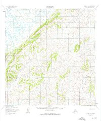
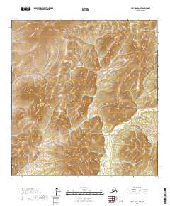
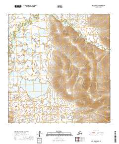
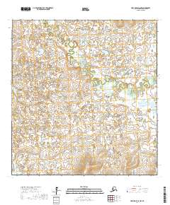
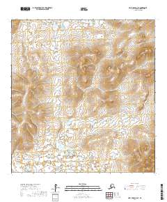
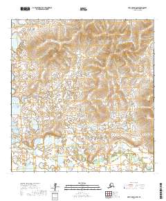
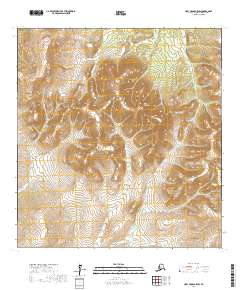
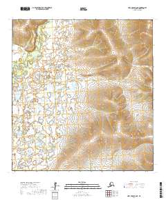
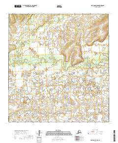
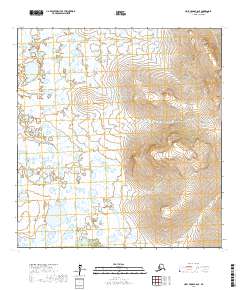
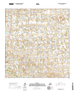
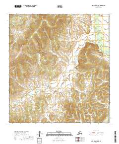
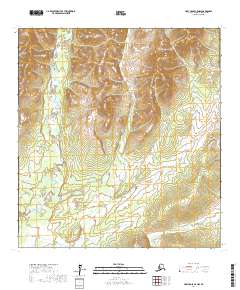
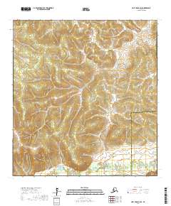
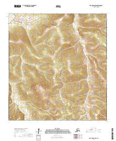
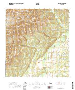
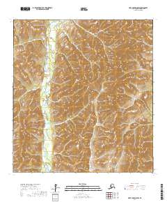
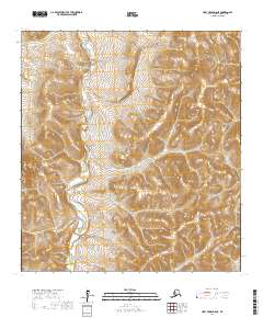
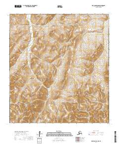
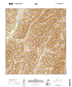
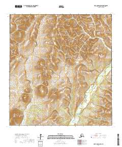
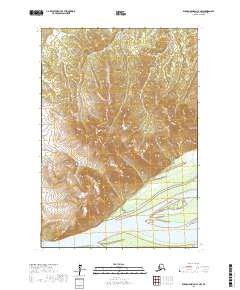
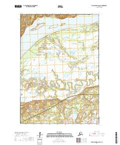
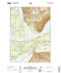
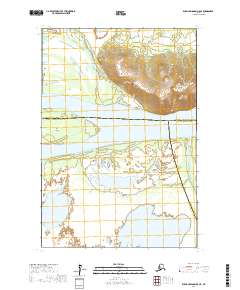
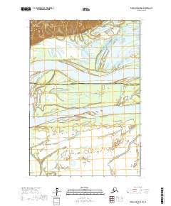
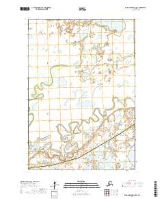
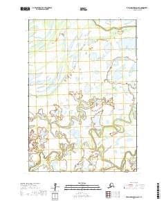
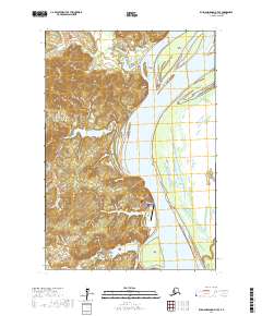
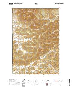
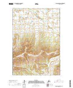
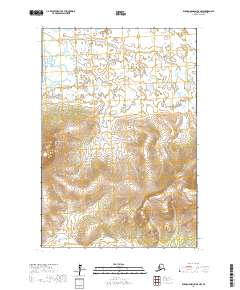
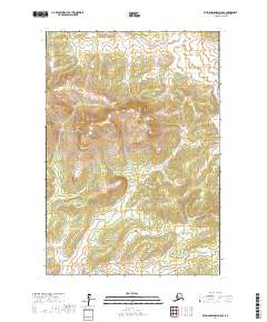
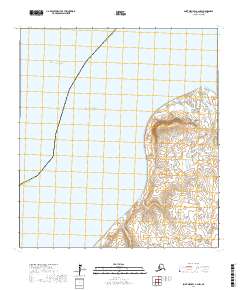
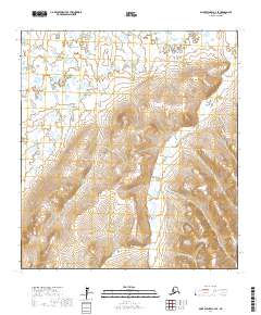
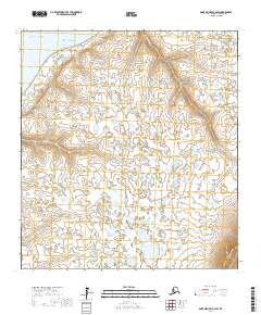
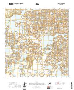
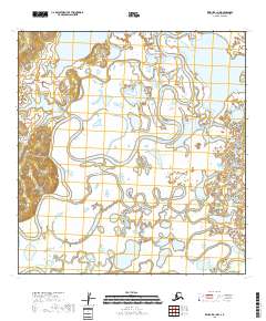
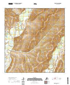
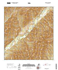
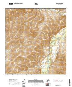
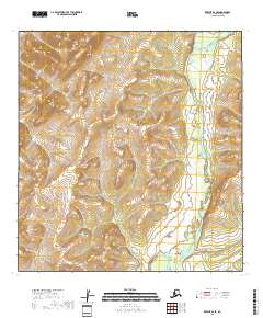
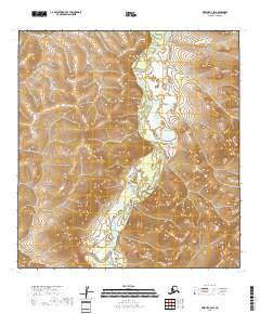
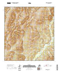
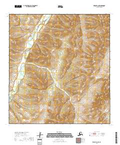
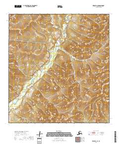
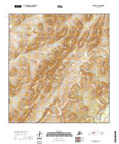
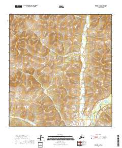
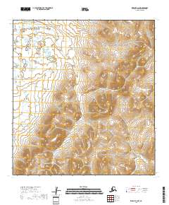
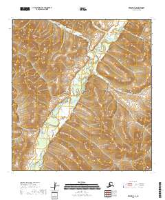
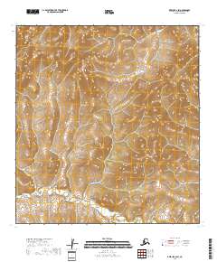
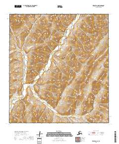
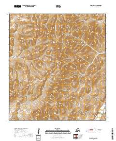
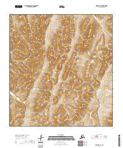
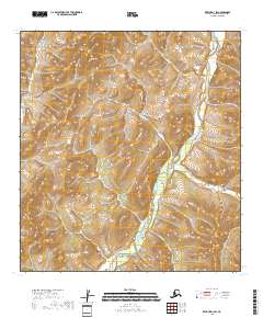
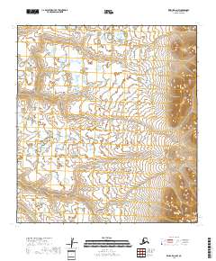
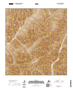
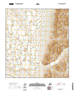
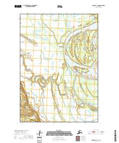
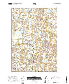
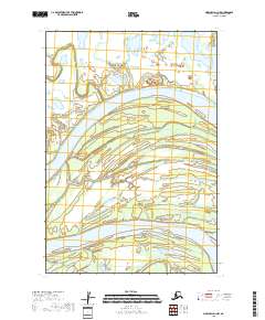
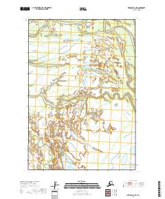
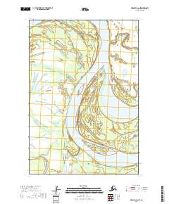
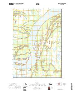
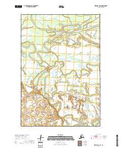
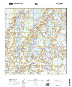
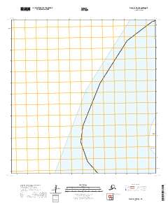
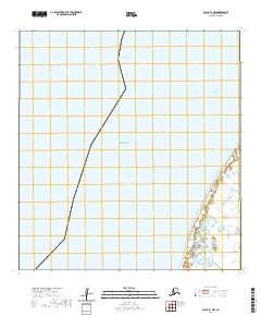
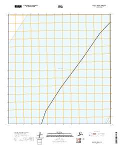
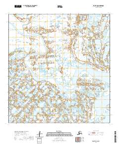
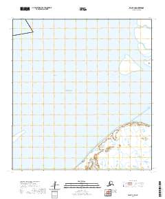
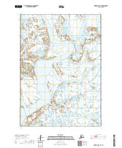
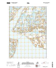
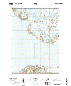
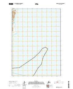
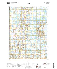
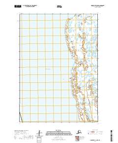
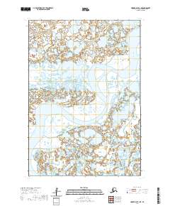
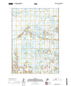
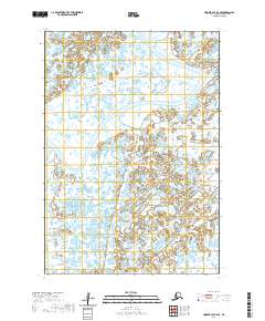
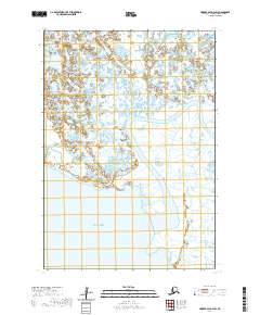
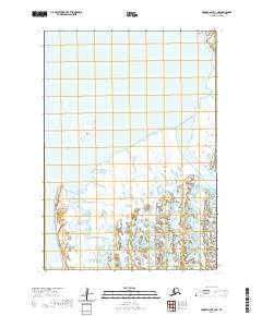
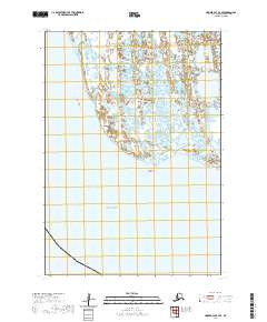
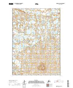
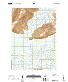
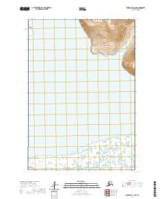
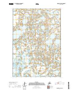
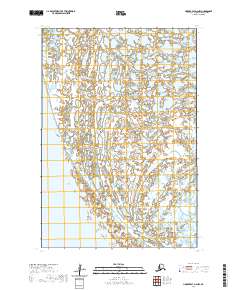
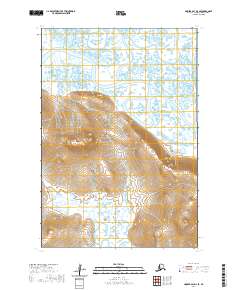
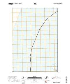
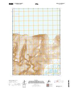
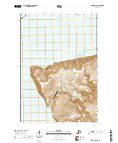
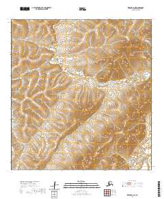
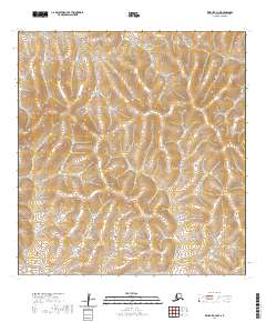
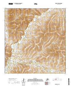
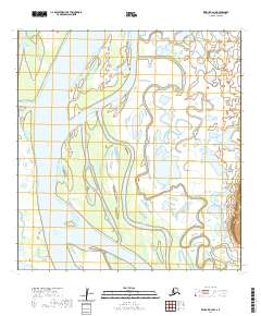
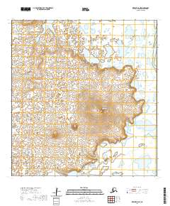
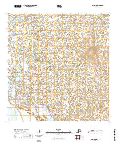
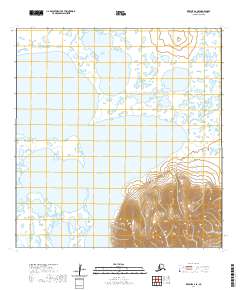
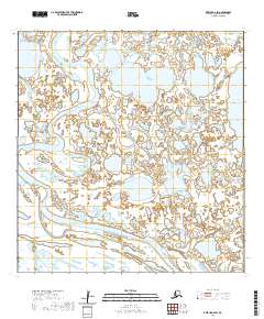
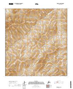
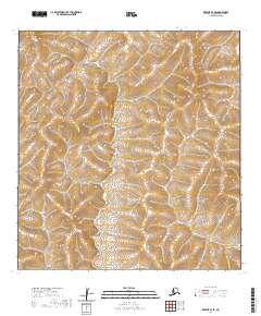
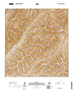
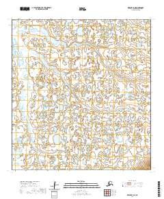
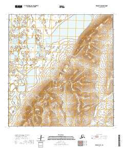
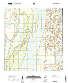
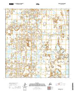
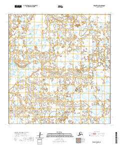
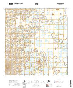
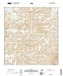
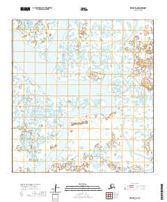
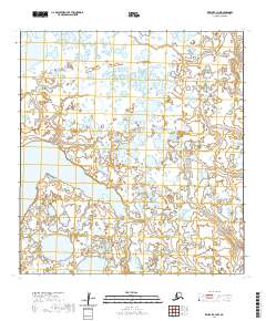
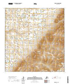
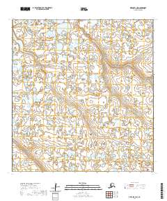
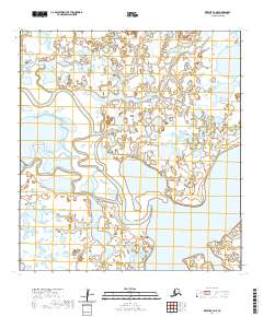
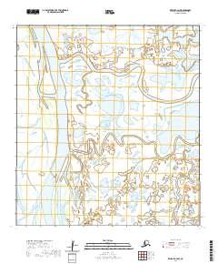
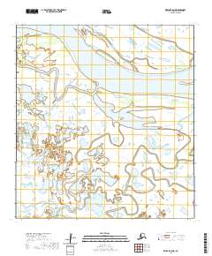
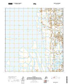
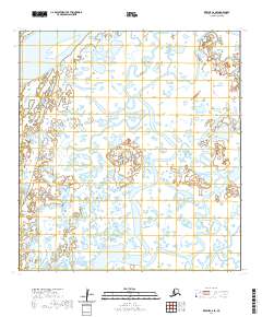
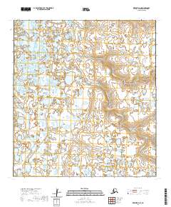
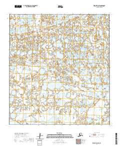
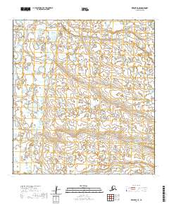
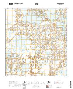
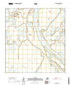
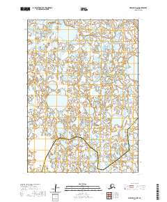
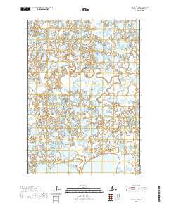
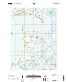
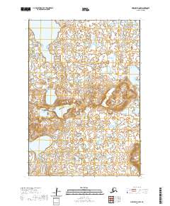
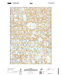
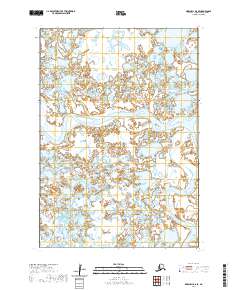
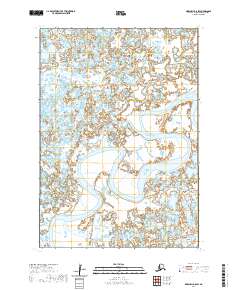
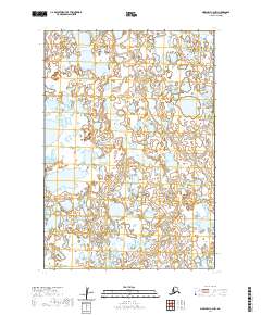
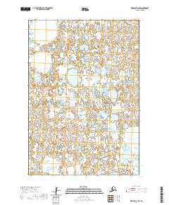
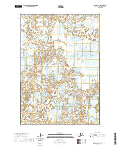
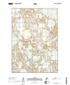
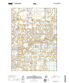
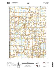
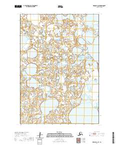
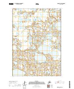
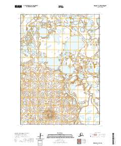
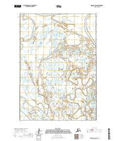
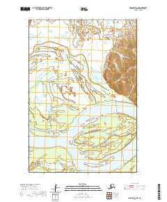
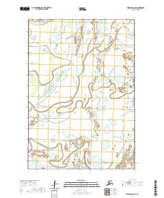
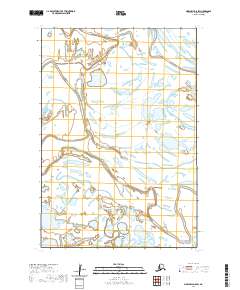
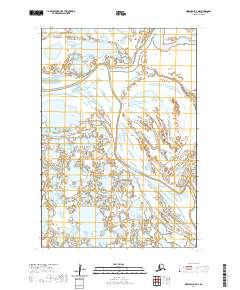
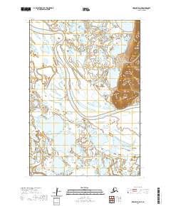
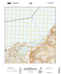
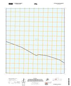
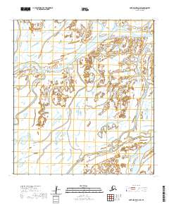
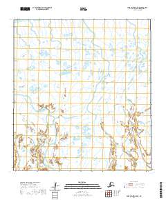
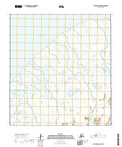
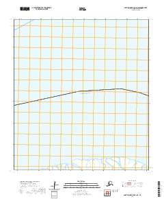
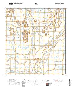
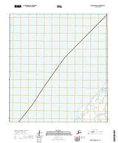
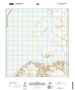
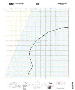
The Ilivit Mountains dominate the southeastern portion of this 1952 topographic study, showing a landscape defined by sharp elevation shifts and an intricate drainage network. In the northern reaches, the Nageethluk River winds across the terrain, joined by smaller tributaries like Tom Gray Creek. The presence of a solitary Cabin in the south provides a rare indicator of human presence in this expanse, likely serving as a seasonal base for hunting or trapping. This survey, based on 1951 aerial photography, captures the interior's hydrological patterns before later revisions, including the flow of the Stuyahok River and Kako Creek. The lack of established road networks underscores the isolation of this region during the mid-twentieth century, where movement was primarily dictated by watercourses and natural ridges.
Find a feature on this map
6 named features on this map. Tap any name to fly to it.
Don’t see what you’re looking for? This feature index may not catch every label — zoom into the map to look around manually.
Map Details
Editions of this 1952 Holy Cross A-5 Map
This is the sole edition of this map. No revisions or reprints were ever made.
Historical Maps of Unorganized Borough Through Time
411 maps found

1951 Black
Kusilvak Borough, AK

1951 Holy Cross A-5
Kusilvak Borough, AK

1951 St Michael
Kusilvak Borough, AK

1952 Black A-1
Kusilvak Borough, AK

1952 Black A-2
Kusilvak Borough, AK

1952 Black B-1
Kusilvak Borough, AK

1952 Black C-1
Kusilvak Borough, AK
1952 Holy Cross A-5
Kusilvak Borough, AK

1952 Holy Cross A-6
Kusilvak Borough, AK

1952 Holy Cross B-5
Kusilvak Borough, AK

1952 Holy Cross B-6
Kusilvak Borough, AK

1952 Holy Cross C-5
Kusilvak Borough, AK

1952 Holy Cross C-6
Kusilvak Borough, AK

1952 Holy Cross D-5
Kusilvak Borough, AK

1952 Holy Cross D-6
Kusilvak Borough, AK

1952 Hooper Bay A-2
Kusilvak Borough, AK

1952 Hooper Bay B-3
Kusilvak Borough, AK

1952 Hooper Bay C-1
Kusilvak Borough, AK

1952 Hooper Bay C-3
Kusilvak Borough, AK

1952 Hooper Bay C-4
Kusilvak Borough, AK

1952 Hooper Bay D-1
Kusilvak Borough, AK

1952 Hooper Bay D-2
Kusilvak Borough, AK

1952 Kwiguk A-1
Kusilvak Borough, AK

1952 Kwiguk A-2
Kusilvak Borough, AK

1952 Kwiguk A-3
Kusilvak Borough, AK

1952 Kwiguk A-4
Kusilvak Borough, AK

1952 Kwiguk A-5
Kusilvak Borough, AK

1952 Kwiguk A-6
Kusilvak Borough, AK

1952 Kwiguk B-1
Kusilvak Borough, AK

1952 Kwiguk B-2
Kusilvak Borough, AK
1952 Kwiguk B-3
Kusilvak Borough, AK

1952 Kwiguk B-4
Kusilvak Borough, AK

1952 Kwiguk B-5
Kusilvak Borough, AK

1952 Kwiguk B-6
Kusilvak Borough, AK

1952 Kwiguk C-1
Kusilvak Borough, AK

1952 Kwiguk C-2
Kusilvak Borough, AK

1952 Kwiguk C-3
Kusilvak Borough, AK

1952 Kwiguk C-4
Kusilvak Borough, AK

1952 Kwiguk C-5
Kusilvak Borough, AK

1952 Kwiguk C-6
Kusilvak Borough, AK

1952 Kwiguk D-1
Kusilvak Borough, AK

1952 Kwiguk D-2
Kusilvak Borough, AK

1952 Kwiguk D-3
Kusilvak Borough, AK

1952 Kwiguk D-4
Kusilvak Borough, AK

1952 Kwiguk D-5
Kusilvak Borough, AK

1952 Kwiguk D-6
Kusilvak Borough, AK

1952 Kwiguk
Kusilvak Borough, AK

1952 Marshall C-1
Kusilvak Borough, AK

1952 Marshall C-5
Kusilvak Borough, AK

1952 Marshall C-6
Kusilvak Borough, AK

1952 Marshall C-7
Kusilvak Borough, AK

1952 Marshall C-8
Kusilvak Borough, AK

1952 Marshall D-1
Kusilvak Borough, AK

1952 Marshall D-2
Kusilvak Borough, AK

1952 Marshall D-3
Kusilvak Borough, AK

1952 Marshall D-4
Kusilvak Borough, AK

1952 Marshall D-5
Kusilvak Borough, AK

1952 Marshall D-6
Kusilvak Borough, AK

1952 Marshall D-7
Kusilvak Borough, AK

1952 Marshall D-8
Kusilvak Borough, AK

1952 Russian Mission C-7
Kusilvak Borough, AK

1952 Russian Mission C-8
Kusilvak Borough, AK

1952 Russian Mission D-5
Kusilvak Borough, AK

1952 Russian Mission D-6
Kusilvak Borough, AK

1952 Russian Mission D-7
Kusilvak Borough, AK

1952 Russian Mission D-8
Kusilvak Borough, AK

1952 Saint Michael A-1
Kusilvak Borough, AK

1952 Saint Michael A-2
Kusilvak Borough, AK

1952 Saint Michael A-3
Kusilvak Borough, AK

1952 Saint Michael A-4
Kusilvak Borough, AK

1952 Saint Michael A-5
Kusilvak Borough, AK

1952 Saint Michael A-6
Kusilvak Borough, AK

1952 St Michael
Kusilvak Borough, AK

1953 Hooper Bay B-1
Kusilvak Borough, AK

1953 Hooper Bay B-2
Kusilvak Borough, AK

1953 Hooper Bay C-2
Kusilvak Borough, AK

1953 Hooper Bay D-3
Kusilvak Borough, AK

1953 Marshall B-5
Kusilvak Borough, AK

1953 Marshall B-6
Kusilvak Borough, AK

1953 Marshall B-7
Kusilvak Borough, AK

1953 Marshall B-8
Kusilvak Borough, AK

1954 Hooper Bay A-1
Kusilvak Borough, AK

1954 Marshall A-7
Kusilvak Borough, AK

1954 Marshall A-8
Kusilvak Borough, AK

1954 Marshall C-2
Kusilvak Borough, AK

1954 Marshall C-3
Kusilvak Borough, AK

1954 Marshall C-4
Kusilvak Borough, AK

1957 Marshall B-7
Kusilvak Borough, AK

1964 St. Michael
Kusilvak Borough, AK
2017 Holy Cross A-5 NE
Kusilvak Borough, AK
2017 Holy Cross A-5 NW
Kusilvak Borough, AK
2017 Holy Cross A-5 SE
Kusilvak Borough, AK
2017 Holy Cross A-5 SW
Kusilvak Borough, AK
2017 Holy Cross A-6 NE
Kusilvak Borough, AK
2017 Holy Cross A-6 NW
Kusilvak Borough, AK
2017 Holy Cross A-6 SE
Kusilvak Borough, AK
2017 Holy Cross A-6 SW
Kusilvak Borough, AK
2017 Holy Cross B-5 NE
Kusilvak Borough, AK
2017 Holy Cross B-5 NW
Kusilvak Borough, AK
2017 Holy Cross B-5 SE
Kusilvak Borough, AK
2017 Holy Cross B-5 SW
Kusilvak Borough, AK
2017 Holy Cross B-6 NE
Kusilvak Borough, AK
2017 Holy Cross B-6 NW
Kusilvak Borough, AK
2017 Holy Cross B-6 SE
Kusilvak Borough, AK
2017 Holy Cross B-6 SW
Kusilvak Borough, AK
2017 Holy Cross C-5 NE
Kusilvak Borough, AK
2017 Holy Cross C-5 NW
Kusilvak Borough, AK
2017 Holy Cross C-5 SE
Kusilvak Borough, AK
2017 Holy Cross C-5 SW
Kusilvak Borough, AK
2017 Holy Cross C-6 NE
Kusilvak Borough, AK
2017 Holy Cross C-6 NW
Kusilvak Borough, AK
2017 Holy Cross C-6 SE
Kusilvak Borough, AK
2017 Holy Cross C-6 SW
Kusilvak Borough, AK
2017 Holy Cross D-5 NE
Kusilvak Borough, AK
2017 Holy Cross D-5 NW
Kusilvak Borough, AK
2017 Holy Cross D-5 SE
Kusilvak Borough, AK
2017 Holy Cross D-5 SW
Kusilvak Borough, AK
2017 Holy Cross D-6 NE
Kusilvak Borough, AK
2017 Holy Cross D-6 NW
Kusilvak Borough, AK
2017 Holy Cross D-6 SE
Kusilvak Borough, AK
2017 Holy Cross D-6 SW
Kusilvak Borough, AK
2017 Russian Mission C-6 NE
Kusilvak Borough, AK
2017 Russian Mission C-6 NW
Kusilvak Borough, AK
2017 Russian Mission C-7 NE
Kusilvak Borough, AK
2017 Russian Mission C-7 NW
Kusilvak Borough, AK
2017 Russian Mission C-7 SW
Kusilvak Borough, AK
2017 Russian Mission C-8 NE
Kusilvak Borough, AK
2017 Russian Mission C-8 NW
Kusilvak Borough, AK
2017 Russian Mission C-8 SE
Kusilvak Borough, AK
2017 Russian Mission C-8 SW
Kusilvak Borough, AK
2017 Russian Mission D-5 NE
Kusilvak Borough, AK
2017 Russian Mission D-5 NW
Kusilvak Borough, AK
2017 Russian Mission D-5 SE
Kusilvak Borough, AK
2017 Russian Mission D-5 SW
Kusilvak Borough, AK
2017 Russian Mission D-6 NE
Kusilvak Borough, AK
2017 Russian Mission D-6 NW
Kusilvak Borough, AK
2017 Russian Mission D-6 SE
Kusilvak Borough, AK
2017 Russian Mission D-6 SW
Kusilvak Borough, AK
2017 Russian Mission D-7 NE
Kusilvak Borough, AK
2017 Russian Mission D-7 NW
Kusilvak Borough, AK
2017 Russian Mission D-7 SE
Kusilvak Borough, AK
2017 Russian Mission D-7 SW
Kusilvak Borough, AK
2017 Russian Mission D-8 NE
Kusilvak Borough, AK
2017 Russian Mission D-8 NW
Kusilvak Borough, AK
2017 Russian Mission D-8 SE
Kusilvak Borough, AK

2017 Russian Mission D-8 SW
Kusilvak Borough, AK
2017 Saint Michael A-1 NW
Kusilvak Borough, AK
2017 Saint Michael A-1 SE
Kusilvak Borough, AK
2017 Saint Michael A-1 SW
Kusilvak Borough, AK

2017 Saint Michael A-2 NE
Kusilvak Borough, AK
2017 Saint Michael A-2 NW
Kusilvak Borough, AK
2017 Saint Michael A-2 SE
Kusilvak Borough, AK
2017 Saint Michael A-2 SW
Kusilvak Borough, AK
2018 Kwiguk A-1 NE
Kusilvak Borough, AK
2018 Kwiguk A-1 NW
Kusilvak Borough, AK
2018 Kwiguk A-1 SE
Kusilvak Borough, AK
2018 Kwiguk A-1 SW
Kusilvak Borough, AK
2018 Kwiguk A-2 NE
Kusilvak Borough, AK
2018 Kwiguk A-2 NW
Kusilvak Borough, AK
2018 Kwiguk A-2 SE
Kusilvak Borough, AK
2018 Kwiguk A-2 SW
Kusilvak Borough, AK
2018 Kwiguk B-1 NE
Kusilvak Borough, AK
2018 Kwiguk B-1 NW
Kusilvak Borough, AK
2018 Kwiguk B-1 SE
Kusilvak Borough, AK
2018 Kwiguk B-1 SW
Kusilvak Borough, AK
2018 Kwiguk B-2 NE
Kusilvak Borough, AK
2018 Kwiguk B-2 NW
Kusilvak Borough, AK
2018 Kwiguk B-2 SE
Kusilvak Borough, AK
2018 Kwiguk B-2 SW
Kusilvak Borough, AK
2018 Kwiguk C-1 NE
Kusilvak Borough, AK
2018 Kwiguk C-1 NW
Kusilvak Borough, AK
2018 Kwiguk C-1 SE
Kusilvak Borough, AK
2018 Kwiguk C-1 SW
Kusilvak Borough, AK
2018 Kwiguk C-2 NE
Kusilvak Borough, AK
2018 Kwiguk C-2 NW
Kusilvak Borough, AK
2018 Kwiguk C-2 SE
Kusilvak Borough, AK
2018 Kwiguk C-2 SW
Kusilvak Borough, AK
2018 Kwiguk D-1 NE
Kusilvak Borough, AK
2018 Kwiguk D-1 NW
Kusilvak Borough, AK
2018 Kwiguk D-1 SE
Kusilvak Borough, AK
2018 Kwiguk D-1 SW
Kusilvak Borough, AK

2018 Kwiguk D-2 NE
Kusilvak Borough, AK
2018 Kwiguk D-2 NW
Kusilvak Borough, AK
2018 Kwiguk D-2 SE
Kusilvak Borough, AK
2018 Kwiguk D-2 SW
Kusilvak Borough, AK
2018 Marshall C-1 NE
Kusilvak Borough, AK
2018 Marshall C-1 NW
Kusilvak Borough, AK
2018 Marshall C-1 SE
Kusilvak Borough, AK
2018 Marshall C-1 SW
Kusilvak Borough, AK
2018 Marshall C-2 NE
Kusilvak Borough, AK
2018 Marshall C-2 NW
Kusilvak Borough, AK
2018 Marshall C-2 SE
Kusilvak Borough, AK
2018 Marshall C-2 SW
Kusilvak Borough, AK
2018 Marshall C-3 NE
Kusilvak Borough, AK
2018 Marshall C-3 SE
Kusilvak Borough, AK

2018 Marshall D-1 NE
Kusilvak Borough, AK
2018 Marshall D-1 NW
Kusilvak Borough, AK

2018 Marshall D-1 SE
Kusilvak Borough, AK
2018 Marshall D-1 SW
Kusilvak Borough, AK
2018 Marshall D-2 NE
Kusilvak Borough, AK
2018 Marshall D-2 NW
Kusilvak Borough, AK
2018 Marshall D-2 SE
Kusilvak Borough, AK
2018 Marshall D-2 SW
Kusilvak Borough, AK

2018 Marshall D-3 NE
Kusilvak Borough, AK
2018 Marshall D-3 SE
Kusilvak Borough, AK
2020 Black A-1 NE
Kusilvak Borough, AK
2020 Black A-1 NW
Kusilvak Borough, AK
2020 Black A-1 SE
Kusilvak Borough, AK
2020 Black A-1 SW
Kusilvak Borough, AK
2020 Black A-2 NE
Kusilvak Borough, AK
2020 Black A-2 OE W SE
Kusilvak Borough, AK
2020 Black A-2 SE
Kusilvak Borough, AK
2020 Black A-2 SW
Kusilvak Borough, AK
2020 Black B-1 NE
Kusilvak Borough, AK
2020 Black B-1 NW
Kusilvak Borough, AK
2020 Black B-1 OE W SE
Kusilvak Borough, AK
2020 Black B-1 SE
Kusilvak Borough, AK

2020 Black B-1 SW
Kusilvak Borough, AK
2020 Black C-1 SE
Kusilvak Borough, AK
2020 Hooper Bay A-1 NE
Kusilvak Borough, AK
2020 Hooper Bay A-1 NW
Kusilvak Borough, AK
2020 Hooper Bay A-1 SE
Kusilvak Borough, AK
2020 Hooper Bay A-1 SW
Kusilvak Borough, AK
2020 Hooper Bay A-2 NE
Kusilvak Borough, AK
2020 Hooper Bay A-2 NW
Kusilvak Borough, AK
2020 Hooper Bay A-2 SE
Kusilvak Borough, AK
2020 Hooper Bay A-2 SW
Kusilvak Borough, AK
2020 Hooper Bay B-1 NE
Kusilvak Borough, AK
2020 Hooper Bay B-1 NW
Kusilvak Borough, AK
2020 Hooper Bay B-1 SE
Kusilvak Borough, AK
2020 Hooper Bay B-1 SW
Kusilvak Borough, AK

2020 Hooper Bay B-2 NE
Kusilvak Borough, AK
2020 Hooper Bay B-2 NW
Kusilvak Borough, AK
2020 Hooper Bay B-2 SE
Kusilvak Borough, AK
2020 Hooper Bay B-2 SW
Kusilvak Borough, AK
2020 Hooper Bay B-3 NE
Kusilvak Borough, AK

2020 Hooper Bay B-3 NW
Kusilvak Borough, AK
2020 Hooper Bay B-3 SE
Kusilvak Borough, AK
2020 Hooper Bay C-1 NE
Kusilvak Borough, AK
2020 Hooper Bay C-1 NW
Kusilvak Borough, AK
2020 Hooper Bay C-1 SE
Kusilvak Borough, AK
2020 Hooper Bay C-1 SW
Kusilvak Borough, AK
2020 Hooper Bay C-2 NE
Kusilvak Borough, AK
2020 Hooper Bay C-2 NW
Kusilvak Borough, AK
2020 Hooper Bay C-2 SE
Kusilvak Borough, AK

2020 Hooper Bay C-2 SW
Kusilvak Borough, AK
2020 Hooper Bay C-3 NE
Kusilvak Borough, AK
2020 Hooper Bay C-3 NW
Kusilvak Borough, AK

2020 Hooper Bay C-3 SE
Kusilvak Borough, AK

2020 Hooper Bay C-3 SW
Kusilvak Borough, AK
2020 Hooper Bay C-4 NE
Kusilvak Borough, AK

2020 Hooper Bay C-4 SE
Kusilvak Borough, AK
2020 Hooper Bay D-1 NE
Kusilvak Borough, AK
2020 Hooper Bay D-1 NW
Kusilvak Borough, AK
2020 Hooper Bay D-1 SE
Kusilvak Borough, AK
2020 Hooper Bay D-1 SW
Kusilvak Borough, AK
2020 Hooper Bay D-2 NE
Kusilvak Borough, AK
2020 Hooper Bay D-2 NW
Kusilvak Borough, AK
2020 Hooper Bay D-2 SE
Kusilvak Borough, AK

2020 Hooper Bay D-2 SW
Kusilvak Borough, AK
2020 Hooper Bay D-3 NE
Kusilvak Borough, AK
2020 Hooper Bay D-3 NW
Kusilvak Borough, AK
2020 Hooper Bay D-3 OE W SE
Kusilvak Borough, AK
2020 Hooper Bay D-3 SE
Kusilvak Borough, AK
2020 Hooper Bay D-3 SW
Kusilvak Borough, AK
2020 Kwiguk A-3 NE
Kusilvak Borough, AK
2020 Kwiguk A-3 NW
Kusilvak Borough, AK

2020 Kwiguk A-3 SE
Kusilvak Borough, AK

2020 Kwiguk A-3 SW
Kusilvak Borough, AK
2020 Kwiguk A-4 NE
Kusilvak Borough, AK
2020 Kwiguk A-4 NW
Kusilvak Borough, AK

2020 Kwiguk A-4 SE
Kusilvak Borough, AK

2020 Kwiguk A-4 SW
Kusilvak Borough, AK
2020 Kwiguk A-5 NE
Kusilvak Borough, AK
2020 Kwiguk A-5 NW
Kusilvak Borough, AK
2020 Kwiguk A-5 SE
Kusilvak Borough, AK
2020 Kwiguk A-5 SW
Kusilvak Borough, AK
2020 Kwiguk A-6 NE
Kusilvak Borough, AK

2020 Kwiguk A-6 NW
Kusilvak Borough, AK
2020 Kwiguk A-6 SE
Kusilvak Borough, AK
2020 Kwiguk A-6 SW
Kusilvak Borough, AK
2020 Kwiguk B-3 NE
Kusilvak Borough, AK

2020 Kwiguk B-3 NW
Kusilvak Borough, AK
2020 Kwiguk B-3 SE
Kusilvak Borough, AK
2020 Kwiguk B-3 SW
Kusilvak Borough, AK
2020 Kwiguk B-4 NE
Kusilvak Borough, AK

2020 Kwiguk B-4 NW
Kusilvak Borough, AK
2020 Kwiguk B-4 SE
Kusilvak Borough, AK
2020 Kwiguk B-4 SW
Kusilvak Borough, AK
2020 Kwiguk B-5 NE
Kusilvak Borough, AK
2020 Kwiguk B-5 NW
Kusilvak Borough, AK
2020 Kwiguk B-5 SE
Kusilvak Borough, AK
2020 Kwiguk B-5 SW
Kusilvak Borough, AK
2020 Kwiguk B-6 NE
Kusilvak Borough, AK

2020 Kwiguk B-6 NW
Kusilvak Borough, AK
2020 Kwiguk B-6 SE
Kusilvak Borough, AK
2020 Kwiguk B-6 SW
Kusilvak Borough, AK
2020 Kwiguk C-3 NE
Kusilvak Borough, AK
2020 Kwiguk C-3 NW
Kusilvak Borough, AK
2020 Kwiguk C-3 SE
Kusilvak Borough, AK
2020 Kwiguk C-3 SW
Kusilvak Borough, AK
2020 Kwiguk C-4 NE
Kusilvak Borough, AK
2020 Kwiguk C-4 NW
Kusilvak Borough, AK
2020 Kwiguk C-4 SE
Kusilvak Borough, AK
2020 Kwiguk C-4 SW
Kusilvak Borough, AK
2020 Kwiguk C-5 NE
Kusilvak Borough, AK
2020 Kwiguk C-5 NW
Kusilvak Borough, AK
2020 Kwiguk C-5 SE
Kusilvak Borough, AK
2020 Kwiguk C-5 SW
Kusilvak Borough, AK
2020 Kwiguk C-6 NE
Kusilvak Borough, AK
2020 Kwiguk C-6 NW
Kusilvak Borough, AK
2020 Kwiguk C-6 SE
Kusilvak Borough, AK

2020 Kwiguk C-6 SW
Kusilvak Borough, AK
2020 Kwiguk D-3 NE
Kusilvak Borough, AK
2020 Kwiguk D-3 NW
Kusilvak Borough, AK
2020 Kwiguk D-3 SE
Kusilvak Borough, AK
2020 Kwiguk D-3 SW
Kusilvak Borough, AK
2020 Kwiguk D-4 NE
Kusilvak Borough, AK
2020 Kwiguk D-4 NW
Kusilvak Borough, AK
2020 Kwiguk D-4 SE
Kusilvak Borough, AK
2020 Kwiguk D-4 SW
Kusilvak Borough, AK
2020 Kwiguk D-5 NE
Kusilvak Borough, AK
2020 Kwiguk D-5 NW
Kusilvak Borough, AK
2020 Kwiguk D-5 SE
Kusilvak Borough, AK

2020 Kwiguk D-5 SW
Kusilvak Borough, AK
2020 Kwiguk D-6 NE
Kusilvak Borough, AK
2020 Kwiguk D-6 NW
Kusilvak Borough, AK

2020 Kwiguk D-6 SE
Kusilvak Borough, AK
2020 Kwiguk D-6 SW
Kusilvak Borough, AK
2020 Marshall A-6 NW
Kusilvak Borough, AK
2020 Marshall A-7 NE
Kusilvak Borough, AK
2020 Marshall A-7 NW
Kusilvak Borough, AK
2020 Marshall A-7 SE
Kusilvak Borough, AK
2020 Marshall A-7 SW
Kusilvak Borough, AK
2020 Marshall A-8 NE
Kusilvak Borough, AK
2020 Marshall A-8 NW
Kusilvak Borough, AK
2020 Marshall A-8 SE
Kusilvak Borough, AK
2020 Marshall A-8 SW
Kusilvak Borough, AK
2020 Marshall B-5 NE
Kusilvak Borough, AK
2020 Marshall B-5 NW
Kusilvak Borough, AK
2020 Marshall B-6 NE
Kusilvak Borough, AK
2020 Marshall B-6 NW
Kusilvak Borough, AK
2020 Marshall B-6 SW
Kusilvak Borough, AK
2020 Marshall B-7 NE
Kusilvak Borough, AK
2020 Marshall B-7 NW
Kusilvak Borough, AK
2020 Marshall B-7 SE
Kusilvak Borough, AK
2020 Marshall B-7 SW
Kusilvak Borough, AK
2020 Marshall B-8 NE
Kusilvak Borough, AK
2020 Marshall B-8 NW
Kusilvak Borough, AK
2020 Marshall B-8 SE
Kusilvak Borough, AK
2020 Marshall B-8 SW
Kusilvak Borough, AK
2020 Marshall C-3 NW
Kusilvak Borough, AK
2020 Marshall C-3 SW
Kusilvak Borough, AK
2020 Marshall C-4 NE
Kusilvak Borough, AK
2020 Marshall C-4 NW
Kusilvak Borough, AK
2020 Marshall C-4 SE
Kusilvak Borough, AK
2020 Marshall C-4 SW
Kusilvak Borough, AK
2020 Marshall C-5 NE
Kusilvak Borough, AK
2020 Marshall C-5 NW
Kusilvak Borough, AK
2020 Marshall C-5 SE
Kusilvak Borough, AK
2020 Marshall C-5 SW
Kusilvak Borough, AK
2020 Marshall C-6 NE
Kusilvak Borough, AK
2020 Marshall C-6 NW
Kusilvak Borough, AK
2020 Marshall C-6 SE
Kusilvak Borough, AK
2020 Marshall C-6 SW
Kusilvak Borough, AK
2020 Marshall C-7 NE
Kusilvak Borough, AK
2020 Marshall C-7 NW
Kusilvak Borough, AK
2020 Marshall C-7 SE
Kusilvak Borough, AK
2020 Marshall C-7 SW
Kusilvak Borough, AK
2020 Marshall C-8 NE
Kusilvak Borough, AK
2020 Marshall C-8 NW
Kusilvak Borough, AK
2020 Marshall C-8 SE
Kusilvak Borough, AK
2020 Marshall C-8 SW
Kusilvak Borough, AK
2020 Marshall D-3 NW
Kusilvak Borough, AK
2020 Marshall D-3 SW
Kusilvak Borough, AK
2020 Marshall D-4 NE
Kusilvak Borough, AK
2020 Marshall D-4 NW
Kusilvak Borough, AK

2020 Marshall D-4 SE
Kusilvak Borough, AK
2020 Marshall D-4 SW
Kusilvak Borough, AK
2020 Marshall D-5 NE
Kusilvak Borough, AK
2020 Marshall D-5 NW
Kusilvak Borough, AK
2020 Marshall D-5 SE
Kusilvak Borough, AK
2020 Marshall D-5 SW
Kusilvak Borough, AK
2020 Marshall D-6 NE
Kusilvak Borough, AK
2020 Marshall D-6 NW
Kusilvak Borough, AK
2020 Marshall D-6 SE
Kusilvak Borough, AK

2020 Marshall D-6 SW
Kusilvak Borough, AK
2020 Marshall D-7 NE
Kusilvak Borough, AK
2020 Marshall D-7 NW
Kusilvak Borough, AK
2020 Marshall D-7 SE
Kusilvak Borough, AK
2020 Marshall D-7 SW
Kusilvak Borough, AK
2020 Marshall D-8 NE
Kusilvak Borough, AK
2020 Marshall D-8 NW
Kusilvak Borough, AK
2020 Marshall D-8 SE
Kusilvak Borough, AK
2020 Marshall D-8 SW
Kusilvak Borough, AK
2020 Saint Michael A-3 SE
Kusilvak Borough, AK

2020 Saint Michael A-3 SW
Kusilvak Borough, AK
2020 Saint Michael A-4 NE
Kusilvak Borough, AK
2020 Saint Michael A-4 NW
Kusilvak Borough, AK
2020 Saint Michael A-4 OE N SE
Kusilvak Borough, AK
2020 Saint Michael A-4 OE N SW
Kusilvak Borough, AK

2020 Saint Michael A-4 SE
Kusilvak Borough, AK
2020 Saint Michael A-4 SW
Kusilvak Borough, AK
2020 Saint Michael A-5 NE
Kusilvak Borough, AK
2020 Saint Michael A-5 NW
Kusilvak Borough, AK
2020 Saint Michael A-5 OE N SE
Kusilvak Borough, AK
2020 Saint Michael A-5 SE
Kusilvak Borough, AK

2020 Saint Michael A-5 SW
Kusilvak Borough, AK
2020 Saint Michael A-6 NE
Kusilvak Borough, AK
2020 Saint Michael A-6 SE
Kusilvak Borough, AK
2020 Saint Michael A-6 SW
Kusilvak Borough, AK