
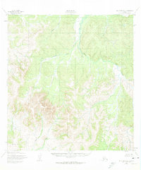
1952 Map of Holy Cross B-5
USGS Topo · Published 1959About this map
Wolf Creek Mountain dominates the southwestern quadrant of this 1952 topographic study, its high peaks rising above a complex drainage system that defines the local geography. The area is characterized by an intricate network of waterways, including the winding Hawk River and the Naghethluk River. Mapping of this interior region was conducted by the Army Map Service using aerial photography from 1951, providing a precise record of the land before significant modern intervention. The topographical detail reveals a stark contrast between the steep elevations of the central peaks and the broader, more gradual terrain of the Rolling Hills. Smaller tributaries such as Little Lockwood Creek, Gray Creek, and Tom Creek carve out the valleys, illustrating the natural watershed patterns of the Kusilvak region.
Find a feature on this map
9 named features on this map. Tap any name to fly to it.
Don’t see what you’re looking for? This feature index may not catch every label — zoom into the map to look around manually.
Map Details
Editions of this 1952 Holy Cross B-5 Map
2 editions found
Other maps of this area

1951 · Holy Cross
USGS Topo · 1:250,000

1951 · Holy Cross A-5
USGS Topo · 1:63,360

1952 · Holy Cross A-4
USGS Topo · 1:63,360

1952 · Holy Cross C-6
USGS Topo · 1:63,360

1952 · Holy Cross C-5
USGS Topo · 1:63,360

1952 · Holy Cross B-6
USGS Topo · 1:63,360

1952 · Holy Cross A-6
USGS Topo · 1:63,360

1952 · Holy Cross C-4
USGS Topo · 1:63,360

1952 · Holy Cross B-4
USGS Topo · 1:63,360

1952 · Holy Cross
USGS Topo · 1:250,000