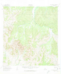
1952 Map of Holy Cross B-5
USGS Topo · Published 1973About this map
Wolf Creek Mountain dominates this interior Alaskan landscape, which was documented by the Army Map Service using aerial photography from 1951. The terrain transitions from the high peaks of the mountain range to the lower Rolling Hills in the southwest, carved by a network of drainage systems including Wolf Creek and Tom Gray Creek. The central valley is defined by the winding course of the Hawk River, which flows through an area of intricate contours and unmapped land lines. Historically, these maps served as essential guides for the Bureau of Land Management to establish predetermined locations across unsurveyed wilderness. Tracing the paths of Jackson Creek and Little Lockwood Creek reveals a remote landscape where water flow dictated the natural corridors long before any established roads or trails reached this portion of the Kusilvak region.
Find a feature on this map
8 named features on this map. Tap any name to fly to it.
Don’t see what you’re looking for? This feature index may not catch every label — zoom into the map to look around manually.
Map Details
Editions of this 1952 Holy Cross B-5 Map
2 editions found
Other maps of this area

1951 · Holy Cross
USGS Topo · 1:250,000

1951 · Holy Cross A-5
USGS Topo · 1:63,360

1952 · Holy Cross A-4
USGS Topo · 1:63,360

1952 · Holy Cross C-6
USGS Topo · 1:63,360

1952 · Holy Cross C-5
USGS Topo · 1:63,360

1952 · Holy Cross B-6
USGS Topo · 1:63,360

1952 · Holy Cross B-5
USGS Topo · 1:63,360

1952 · Holy Cross A-6
USGS Topo · 1:63,360

1952 · Holy Cross C-4
USGS Topo · 1:63,360

1952 · Holy Cross B-4
USGS Topo · 1:63,360