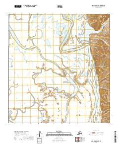
2019 Map of Holy Cross B-2 NE
USGS Topo · Published 2019About this map
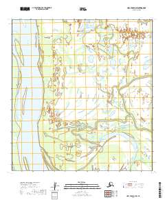
Innoko River dominates this interior landscape, winding in tight oxbows and broad meanders through a vast network of wetlands and seasonal floodplains. This 2019 survey by the U.S. Geological Survey documents a remote reach of the Yukon-Koyukuk Census Area where the shifting hydrology creates an intricate pattern of sloughs and abandoned river channels. The terrain is characterized by the extreme flatness of the river basin, punctuated only by the subtle topographic rises in the eastern portion of the quadrangle. Mapping this region relies on precise public land survey data, including boundaries for t28n r56w and t27n r55w, reflecting the systematic grid used to organize this sparsely inhabited subarctic wilderness.
Find a feature on this map
8 named features on this map. Tap any name to fly to it.
Don’t see what you’re looking for? This feature index may not catch every label — zoom into the map to look around manually.
Map Details
Editions of this 2019 Holy Cross B-2 NE Map
This is the sole edition of this map. No revisions or reprints were ever made.
Other maps of this area

1951 · Holy Cross
USGS Topo · 1:250,000

1952 · Holy Cross B-2
USGS Topo · 1:63,360

1952 · Holy Cross C-2
USGS Topo · 1:63,360

1952 · Holy Cross C-1
USGS Topo · 1:63,360

1952 · Holy Cross B-1
USGS Topo · 1:63,360

1952 · Holy Cross
USGS Topo · 1:250,000
2019 · Holy Cross C-2 SE
USGS Topo · 1:25,000
2019 · Holy Cross B-2 SE
USGS Topo · 1:25,000
2019 · Holy Cross B-1 SW
USGS Topo · 1:25,000
2019 · Holy Cross B-2 SW
USGS Topo · 1:25,000