
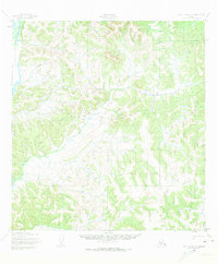
1952 Map of Holy Cross C-1
USGS Topo · Published 1959About this map
The Innoko River winds through the northwestern corner of this territory, representing a critical water artery in a landscape defined by sharp elevation changes and dense drainage patterns. Based on 1951 aerial photography, this map documents the area during a period of active aerial surveying by the Army Map Service. The presence of a Winter Trail cutting across the northern hills illustrates the seasonal nature of overland travel in this part of Alaska, where frozen ground provided the only reliable path for movement between river basins. The lack of permanent structures or towns on the sheet highlights the isolation of this interior wilderness, where human activity was largely restricted to these established transit corridors and the navigable reaches of the river.
Find a feature on this map
2 named features on this map. Tap any name to fly to it.
Don’t see what you’re looking for? This feature index may not catch every label — zoom into the map to look around manually.
Map Details
Editions of this 1952 Holy Cross C-1 Map
2 editions found
Other maps of this area

1951 · Holy Cross
USGS Topo · 1:250,000

1951 · Iditarod
USGS Topo · 1:250,000

1952 · Holy Cross B-2
USGS Topo · 1:63,360

1952 · Holy Cross C-2
USGS Topo · 1:63,360

1952 · Holy Cross D-2
USGS Topo · 1:63,360

1952 · Holy Cross B-1
USGS Topo · 1:63,360

1952 · Holy Cross D-1
USGS Topo · 1:63,360

1952 · Holy Cross
USGS Topo · 1:250,000

1954 · Iditarod D-6
USGS Topo · 1:63,360
1954 · Iditarod C-6
USGS Topo · 1:63,360