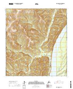
2017 Map of Holy Cross D-3 NE
USGS Topo · Published 2017About this map
The community of Grayling sits along the west bank of the Yukon River, serving as a vital interior outpost where the water meets the eastern edge of the Nulato Hills. This 2017 study illustrates the concentrated layout of the settlement, with residential paths like Third Street and Hill Street leading toward the riverfront. The infrastructure reflects a landscape where travel is dictated by geography, centered on the Grayling Airport and a small network of local roads including Cemetery Lane and Grayling Landfill Road.
Find a feature on this map
18 named features on this map. Tap any name to fly to it.
Don’t see what you’re looking for? This feature index may not catch every label — zoom into the map to look around manually.
Map Details
Editions of this 2017 Holy Cross D-3 NE Map
This is the sole edition of this map. No revisions or reprints were ever made.
Other maps of this area

1951 · Unalakleet
USGS Topo · 1:250,000

1951 · Holy Cross
USGS Topo · 1:250,000

1952 · Unalakleet A-2
USGS Topo · 1:63,360

1952 · Unalakleet A-3
USGS Topo · 1:63,360

1952 · Holy Cross D-2
USGS Topo · 1:63,360

1952 · Holy Cross D-3
USGS Topo · 1:63,360

1952 · Unalakleet
USGS Topo · 1:250,000

1952 · Holy Cross
USGS Topo · 1:250,000

1964 · Unalakleet
USGS Topo · 1:250,000
2015 · Unalakleet A-3 SW
USGS Topo · 1:25,000