
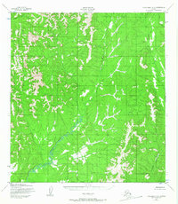
1952 Map of Unalakleet A-3
USGS Topo · Published 1959About this map
Yellow River meanders sharply through this interior Alaskan wilderness, carving a deep valley that dominates the southwestern quadrant of the landscape. Based on aerial photography from 1951, this survey documents a roadless territory where watercourses served as the primary natural landmarks. In the northern reaches, Canyon Creek cuts through steep elevations, while the eastern portion of the sheet is defined by the drainage basins of Grayling Creek and Thompson Creek. The intricate contour lines illustrate a terrain of significant relief, with numerous unnamed peaks and ridges rising sharply from the river valleys, captured at a time when much of this region remained unchecked on the ground.
Find a feature on this map
4 named features on this map. Tap any name to fly to it.
Don’t see what you’re looking for? This feature index may not catch every label — zoom into the map to look around manually.
Map Details
Editions of this 1952 Unalakleet A-3 Map
2 editions found
Other maps of this area

1951 · Unalakleet
USGS Topo · 1:250,000

1951 · Holy Cross
USGS Topo · 1:250,000

1952 · Unalakleet A-2
USGS Topo · 1:63,360

1952 · Unalakleet A-4
USGS Topo · 1:63,360

1952 · Unalakleet B-4
USGS Topo · 1:63,360

1952 · Holy Cross D-4
USGS Topo · 1:63,360

1952 · Holy Cross D-2
USGS Topo · 1:63,360

1952 · Holy Cross D-3
USGS Topo · 1:63,360

1952 · Unalakleet B-3
USGS Topo · 1:63,360

1952 · Unalakleet B-2
USGS Topo · 1:63,360